Elevation: 9,911 ft
Prominence: 331

This peak is not in the book. Updated November 2024
Peak 9911 is one of three high 9,000-foot peaks located above the Chamberlain Creek drainage (Peak 9911, Peak 9743, and Peak 9965). Peak 9911 is on the Continental Divide and is the first ranked summit north of Cottonwood Benchmark (11,029 feet). It is most easily reached from the Eighteenmile Creek Trailhead. USGS Cottonwood Creek
Access
From ID-28 about 0.1 miles north of Gilmore and the Meadow Lake Road turnoff, turn right/northeast onto [signed] MacFarland Boulevard. Reset your odometer at this junction. At 4.8 miles, reach an unsigned 4-way road junction (EighteenmileRoad crosses here). Continue straight and reach a “T” junction at 4.9 miles. There is an Eighteenmile WSA BLM sign here. Go right/east here onto [unsigned] McGinty Creek Road. This road leads directly to the Eighteenmile Creek Trailhead. At 11.1 miles, reach the large parking area and the unsigned Eighteenmile Creek Trailhead (7,755 feet and 44⁰28’58”N, 113⁰05’10”W).
Map Errors
The roads and road conditions in this area are inaccurate on both the National Forest map and the USGS topo map. McGinty Creek Road is a good 2-track road. It is a one-lane road that is mostly gravel with one dirt section. There are no side roads along the way from its unsigned junction with McFarland Boulevard (6.2 miles). It weaves around a bit but generally heads east. The old jeep roads on the USGS topo map (now closed to motorized vehicles in the Eighteenmile Wilderness Study Area) are now used as hiking and horse trails. Some of these old roads are only foot trails now.
The USGS topo map is completely erroneous on the roads leading from McFarland Boulevard to the Eighteenmile Creek Trailhead. The side roads don’t exist anymore and the position of the main road (McGinty Creek Road) is inaccurate. In addition, the USGS topo map shows the main road continuing farther east than it actually does. Pay no attention to the USGS topo map when driving east on McGinty Creek Road.
Southwest Shoulder/West Ridge, Class 2
The Climb
From the Eighteenmile Creek Trailhead, hike along a foot trail that follows an old road bed west then northwest over a shoulder and down 80 vertical feet to [signed] Eighteenmile Creek. Cross three cattle fence gates on the way to the creek. Cross the creek on a plank and continue north on an old jeep track from the creek crossing for a short distance. The road fords [small] Pass Creek. Immediately after jumping across Pass Creek, find an overgrown 2-track road heading right/northeast up the left/north side of Pass Creek. This road is still shown on the USGS topo map.
Hike up this overgrown, 2-track road to a gated road closure and a merger with the old Pass Creek Jeep Road (also shown on the USGS topo map). Climb over the gate and hike up a foot trail in the old road bed. The foot trail heads east then southeast then northeast up the Pass Creek drainage to an old split-rail closure gate. The old 2-track continues briefly after this gate and then disappears in a grass and sagebrush meadow. Pick up a good use trail at the upstream end of this meadow and follow it to the base of the [obvious] southwest shoulder of Peak 9911. The entire hike to this point has been in open terrain and on trails or old roads.
Leave the well-beaten foot trail here. The trail probably follows the Pass Creek drainage up to the Continental Divide. Scramble northeast up steep grass. Scrub, scree/gravel, and scattered pines soon join the mix. Reach a flat, grassy spot then continue north then northeast up an open slope of steep-ish scree. Goat/elk trails help here. Follow a game trail diagonally right/northeast up the angled scree to reach a saddle on the high west ridge between two gentle ridge humps. Scramble northeast up grass and gravel over a ridge hump.
From this gentle, open ridge hump, descend 40 vertical feet in easy field grass to a saddle. From this saddle, head east up easy field grass over another ridge hump. Descend slightly to a final ridge notch then bend left/north and scramble up easy field grass and gravel to reach the cairned summit of Peak 9911. There is an ID/MT iron boundary post in the summit cairn. After all, this is the Continental Divide and the border of Idaho and Montana.

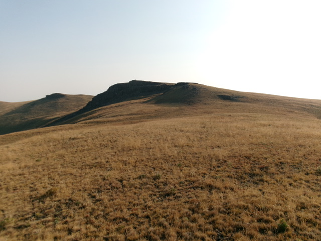
Peak 9911 (dead center) as viewed from the north-northeast on the Continental Divide. Livingston Douglas Photo

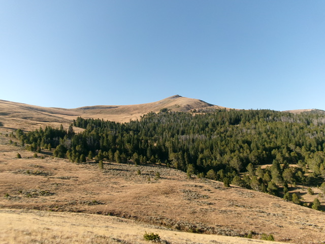
The final push to the summit in the grassy terrain on the west ridge. The cairned summit hump is just left of center. Livingston Douglas Photo
Additional Resources
Regions: Beaverhead Range->EASTERN IDAHO
Mountain Range: Beaverhead Range
Longitude: -113.0247 Latitude: 44.4979
