Elevation: 9,660 ft
Prominence: 400

This peak is not in the book. Published November 2024
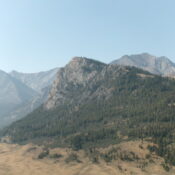
Peak 9660 is a rocky, intimidating peak that sits at the confluence of the West Fork Pahsimeroi River and the East Fork Pahsimeroi River. It is one of several foothills on the north side of the Lost River Range. The east face of Peak 9660 is very rugged. The peak is seldom visited. USGS Leatherman Peak
Access
East Fork Pahsimeroi Road/FSR-118 [(C)(3.2) on Page 294 of the Book]. From the signed junction of the West Fork Pahsimeroi Road and East Fork Pahsimeroi Road, drive 0.6 miles south up the rocky East Fork Pahsimeroi Road to a fording of the West Fork Pahsimeroi River (wide and shallow here). Drive across the river and park at an unsigned spur road junction on the south side of the river (7,775 feet and 44⁰09’18”N, 113⁰42’26”W).
The Upper Pahsimeroi Road/FSR-118 is in poor condition from its signed junction with FSR-318 (a spur road to a campsite). This junction is 0.2 miles past (south of) the fording of Mahogany Creek. The final 3.2 miles from this junction to the fork in the canyon and the split in the road for East Fork Pahsimeroi Road and West Fork Pahsimeroi Road is rugged and awful. The protruding rocks/boulders are endless. The road is braided in many sections. It is a very slow plod. You must have a 4WD vehicle with high clearance and good tires to make it to the fork in the canyon.
North Ridge/West Face, Class 2-3
The Climb
From the road junction, hike briefly southeast on East Fork Pahsimeroi Road. Leave it to hike right/south up an unmapped 2-track road. This 2-track follows the right/west side of a fence row and ends in a pine forest at the mouth of a forested, dry drainage. From there, the drainage has a cattle/use trail that goes well up the drainage. It makes for a good alternative ascent route to my chosen route. My route crosses the head of this drainage at about 8,600 feet.
From the end of the 2-track road, scramble right/southwest up open scrub onto the crest of the [nearby] north ridge. The aforementioned drainage separates the two north ridges of Peak 9660. The eastern ridge is very steep and rocky. It has impassable towers at 9,080 feet and a series of difficult towers from 9,400 feet up to the summit area. It has probably never been climbed. My route follows the western of the two north ridges. This ridge is quite open and easy and has no ridge rock. It stands in stark contrast to its eastern brother.
Once on the north ridge, follow it south in a mix of sagebrush and [mostly] short field grass. The wide, rounded ridge has several ups and downs on its way to Point 8705. From Point 8705, descend south on a cattle trail to cross a dry gully and head right-ish/southwest up a diagonal cattle trail to regain the ridge crest. Continue southwest then south-southwest on the easy, grassy ridge to reach a high basin of sorts. Angle left-ish/southeast to cross a dry gully high up.
Once across this sagebrush-filled gully, scramble southeast up a mostly-open shoulder (just right/southwest of a patch of forest) to reach a high ridge that heads left/northeast. Follow this ridge in easy, short grass and scrub up over a ridge hump. Drop 25 feet to a grassy ridge saddle/notch at the base of the rocky summit massif of Peak 9660. Directly above this saddle, the west face has impassable cliff bands. Head left/northeast up a diagonal game trail in semi-open pine forest to reach a rocky shoulder crossing.
The terrain between here and the summit is a mix of arete/shoulder rock and steep-ish forested terrain with a gravel/duff base. The understory is nil and there is little deadfall. This shoulder leads directly up to the rocky summit area. Leave the game trail and climb right/east up the Class 2+/3 shoulder (or, better yet, continue past the shoulder and THEN climb up the forested face to quickly find a Class 2 chute that heads directly to the summit ridge). The shoulder soon reaches a massive ridge block/buttress.
Go left/north here and skirt the base of this massive buttress to reach a splendid, Class 2 chute that heads directly right/southeast up to the summit ridge. Once on the ridge crest at the top of the chute, scramble a short distance right/south to the rocky summit perch. There was a modest cairn on the highest boulder, which I built up a bit. There is a measured, rocky point a short distance to the northeast of the true/LOJ summit. It is Point 9641.
If you do the ridge traverse over to it and climb it (a steep, Class 4 finish), it measures at 15 feet lower, according to my altimeter. From the true/southwest summit, the northeast summit block looks slightly lower and it is. On the descent, I dropped into the original forested gully sooner and followed an excellent use trail down through the forest to the top of the 2-track road. From there, I hiked down the 2-track road to East Fork Pahsimeroi Road and then back down to the road junction.

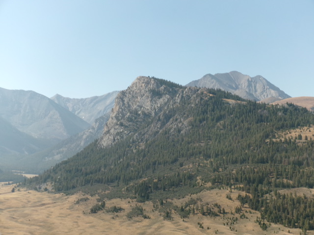
Looking up the final section of the north ridge (right of center). The final high ridge is left of center and the summit massif is at far left. This was my ascent route. Livingston Douglas Photo

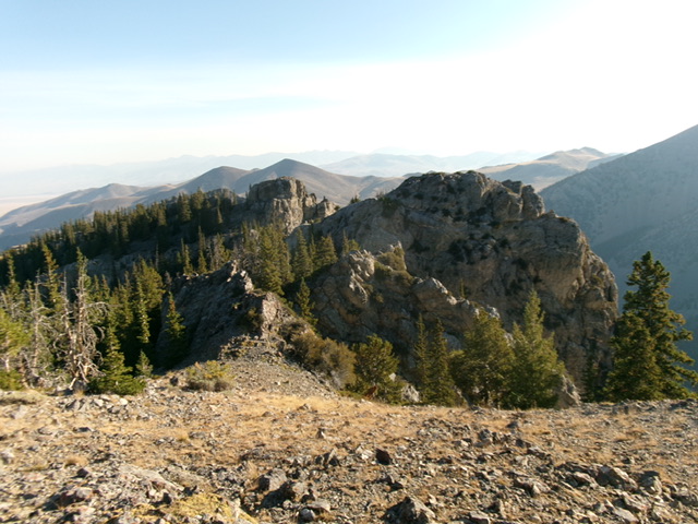
The rocky summit area of Peak 9660. This shot looks from the summit at Point 9641 (the northeast summit), right of center. Another rocky tower farther northeast is just left of center. Livingston Douglas Photo
Additional Resources
Regions: EASTERN IDAHO->Lost River Range
Mountain Range: Lost River Range
Longitude: -113.7068 Latitude: 44.1247
