Elevation: 9,053 ft
Prominence: 311
This peak is not in the book. I believe the Native American name, Pia Soko Katete, is either Bannock or Shoshone. I have not been able to find a translation. The official name replaces the original name, Squawtip, which still resides on most maps. Published November 2024
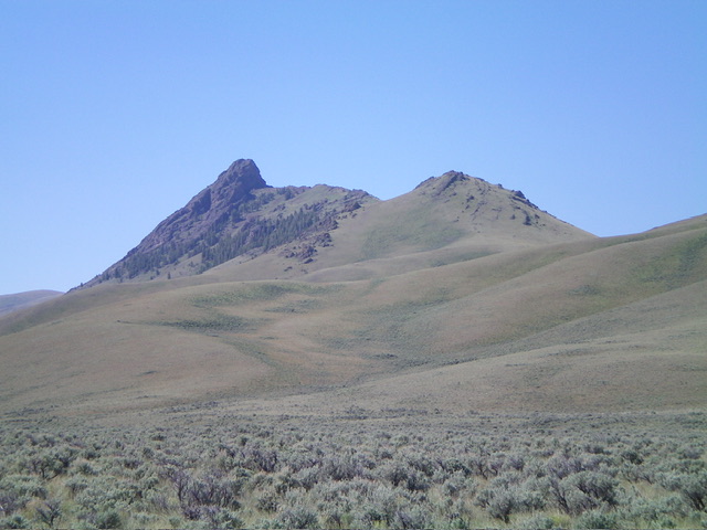
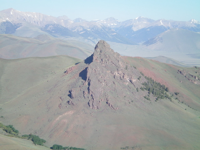
Pia Soko Katete is a magnificent piece of rock that is located between the Donkey Hills and the main crest of the Lost River Range. It is most easily climbed from Short Creek Road to its east. USGS Short Creek
Access
From its signed junction with Lower Dry Creek Road, drive west on Long Creek Road (which becomes Donkey Hills Road) for 5.6 miles to a signed junction with BLM-150/Short Creek Road. This junction is 0.6 miles west of Elkhorn Creek Road (see Access Section for Donkey Hills HP). Turn left/south onto Short Creek Road and drive 2.8 miles on this narrow, rugged 4WD road to reach a patch of aspens and a stream crossing. Park/camp here (7,955 feet and 44⁰10’28”N, 113⁰36’19”W). This is the closest parking spot for a climb of Pia Soko Katete.
Map Errors
The USGS topo map incorrectly positions Short Creek Road. The road eventually rises well above Short Creek and goes much farther up Short Creek, as per the National Forest map. The USGS topo map shows several jeep roads near Short Creek Road that no longer exist. Short Creek Road is a poorly-maintained 2-track road that is overgrown, rocky in sections, rutted in other sections, and narrow with very few areas to pull out or turn around. Be advised.
Northeast Face, Class 4
The Climb
From the grassy parking/camping spot, walk briefly northeast up Short Creek Road. Leave the road and scramble left/northwest up through field grass and sagebrush, passing by Baugher’s “split in the east face,” which is actually more of a series of headwalls and a ridge saddle of sorts. Continue to angle up and left to get closer to the base of the cliffs on the east face. Cross a few rocky aretes (with pines mixed in) to find a series of steep chutes and aretes on the northeast face.
Climb up the steep rock of the northeast face in a combination of chutes, aretes, and face rock. This is difficult, tedious work (Class 4). Reach a ridge notch just northwest of the summit block. The ridge crest is blocked by a massive block/tower here. Skirt the left/north side of this tower and climb diagonally across and up a series of aretes, ledges, and chutes to reach easier terrain high up on the east face, just below the summit block. Briefly climb up the east face to quickly reach the crest of the southeast ridge. Scramble right/northwest up a few more steep chutes and face rock/blocks to reach the summit of Pia Soko Katete. The summit of Pia Soko Katete has a USGS benchmark and a summit cairn nearby.
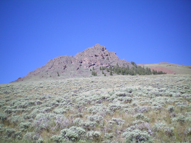
Pia Soko Katete and its rugged northeast face above the pines. This was my ascent route. Livingston Douglas Photo
Southeast Ridge/East Face, Class 3+
The Descent
From the summit, descend the steep, rocky southeast ridge to reach a promising, wide gully just above, and northwest of, a rocky prow at the southeast end of the rocky summit ridge. The head of this prominent gully is probably the “split in the east face” of Baugher’s route. Downclimb steep aretes, face rock, and chutes to reach this critical gully. Once in the gully, descend left/east down a combination of steep face rock, ledges, aretes, and chutes to reach the sagebrush slope below. There are a series of headwalls in this gully that must be downclimbed (Class 3+). Given how Pia Soko Katete looks from a distance (see photos), it is a wonder that there is any Class 3+ or Class 4 route on this peak. Have your climbing skills tuned up before you attempt to climb Pia Soko Katete. You will need them.
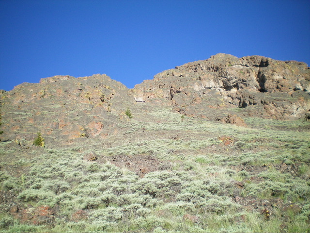
The base of the east gully and the gap in the ridge. The summit is right of center. This was my descent route. Livingston Douglas Photo
Additional Resources
Regions: EASTERN IDAHO->Lost River Range
Mountain Range: Lost River Range
First Ascent Information:
- Other First Ascent: Northeast Face
- Year: 2024
- Season: Summer
- Party: Livingston Douglas
Longitude: -113.61097 Latitude: 44.17757
