Elevation: 10,525 ft
Prominence: 505
Climbing and access information for this peak is on Page 256 of the book, where it is identified as Drummond Peak. It was recently brought to my attention that the government’s Geographic Names Information System now identifies this peak as Pioneer Mountain. See the linked trip reports below for details about John Platt and Dan Robbins’ 4-peak day which did this peak and its neighbors in a time-consuming reverse order from Livingston Douglas’ route. Updated November 2024
Drummond Peak is the high point of this 4-peak ridge traverse from Coco Peak (10,420 feet) to South Star Hope Peak (10,493 feet). It sits above the Drummond Mine and at the headwaters of Star Hope Creek. The north and northwest faces of Drummond Peak are spectacularly rugged and sheer. USGS Star Hope Mine
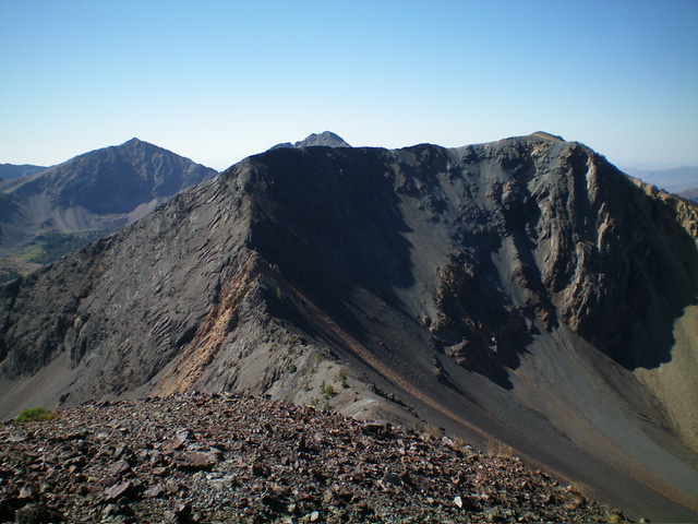
Drummond Peak as viewed from South Star Hope Peak to its north. My descent route is the high ridgeline and the rugged ridgeline left of center (coming at the camera). Livingston Douglas Photo
Access
Same as for Coco Peak. This is the third leg of a 4-peak adventure that includes Coco Peak (10,420 feet), Skyline Peak(10,248 feet), Drummond Peak, and South Star Hope Peak (10,493 feet). It covers 7.0 miles with 3,850 feet of elevation gain round trip.
Map Errors
Maps fail to show the full extent of Star Hope Creek Road. It becomes a Jeep/ATV Road then a rugged ATV Trail soon after the old mining road where I parked. The rugged, narrow 2-track goes all the way to a high basin at about 9,600 feet. It makes for a good hiking trail and is used by ATVs up to about 8,900 feet. Beyond that, it is not even drivable by ATVs.
Northwest Ridge, Class 2
The Climb
From the 9,660-foot connecting saddle with Skyline Peak, climb east-southeast then southeast then east up the meandering northwest ridge. The ridge terrain is steep in sections and has some loose scree. Goat trails help navigate some of these areas. Higher up, the ridge is forested for a portion of the ridge crest. Stay on the ridge crest on solid ground rock or on its left/north edge for the best footing. The final push to the summit is on nice, firm tundra. The summit of Drummond Peak had a torn-down cairn so I rebuilt it.
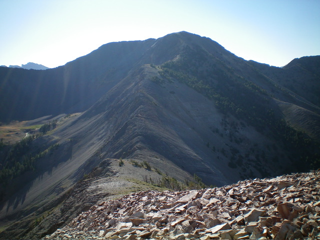
Drummond Peak and its weaving northwest ridge (center and left of center) as viewed from Skyline Peak. This was my ascent route. Livingston Douglas Photo
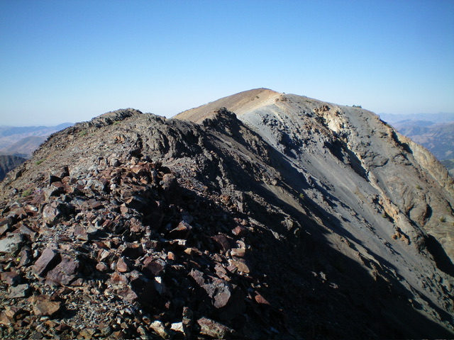
Looking southwest at the summit of Drummond Peak from high on the rocky north ridge. This was my descent route. Livingston Douglas Photo
North Ridge, Class 3+
The Descent
From the summit, descend northeast on a high ridge finger that is a mix of ridge outcrops and scree (Class 2). There are two or three minor uphills when descending the ridge finger, demanding about 40 feet of extra elevation gain. The ridge bends hard left/north and looks ominous. There are lots of ridge towers and ridge chop down to the connecting saddle with gentle South Star Hope Peak. Downclimb the rocky, tower-clad ridge crest (the sides of which are even worse). Navigate steep, loose scree/gravel and crumbly towers that never end.
The crumbly rock towers even extend across the connecting saddle. One major tower goes at Class 3+ (as Robbins notes) and has some exposure, but the rock was solid. All of the downclimbing and tower-skirting takes patience and time. The 10,100-foot connecting saddle with South Star Hope Peak (10,493 feet) is narrow and riddled with ridge towers. It is lengthy and tedious. This saddle concludes the third leg of today’s 4-peak journey. South Star Hope Peak is up next.
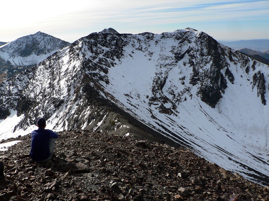
Pioneer Mountain. Dan Robbins Photo
Additional Resources
Regions: EASTERN IDAHO->Pioneer Mountains
Mountain Range: Pioneer Mountains
Longitude: -113.91281 Latitude: 43.67129