Elevation: 5,460 ft
Prominence: 120

This peak is not in the book. Updated October 2025
Reno Point sits at the southern tip of the Beaverhead Mountains on the east side of the Birch Creek Valley. It is most easily climbed from a BLM spur road to its west. USGS Scott Butte
Reno Point as viewed from the west. The summit ridge crest is left of center. Climb over (or skirt) the gentle hump right of center to reach it. Livingston Douglas Photo
Access
From ID-28 just northwest of the [signed] northern boundary of INL land (at virtual MM33.7), turn right/east onto a weak, 2-track BLM road that heads east-southeast for 0.2 miles to the INL boundary. Park along the road on BLM land just outside the boundary line [5,340 feet; 44°00’59.4”N, 112°46’28.1”W].
Southwest Ridge, Class 2
The Climb
From the improvised parking pullout, bushwhack east in easy, short scrub. Stay left/north of the [signed] INL boundary line. Reach a brushy gully crossing with tall sagebrush. Drop about five feet to cross the gully then scramble up a gentle, almost bare, scrub hump then drop slightly to continue northeast up the rocky ridge to reach the north-south summit ridge crest. The high point of Reno Point is in the middle of this ridge crest and has a benchmark atop it. The LOJ position of the high point is a bit too far north and is about 10 feet lower than the actual summit. You can avoid the aforementioned scrub hump by staying in an easy gully to its left/north to reach the rocky ridge crest and avoid the 10-foot drop.
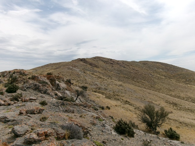
Looking up the rocky southwest ridge of Reno Point. The summit is in dead center. This was my ascent route. Livingston Douglas Photo
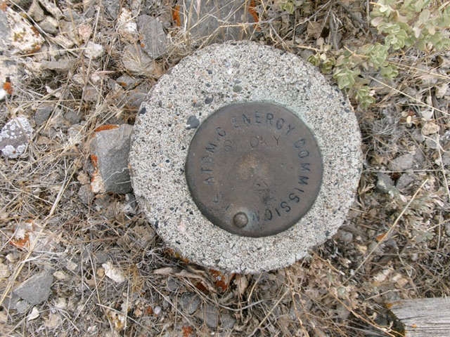
The U.S. Atomic Energy Commission benchmark on the summit. Don’t worry–this is BLM land, not INL land! Livingston Douglas Photo
Additional Resources
Regions: Beaverhead Range->EASTERN IDAHO
Mountain Range: Beaverhead Range
Longitude: -112.7526 Latitude: 44.0172