Elevation: 8,693 ft
Prominence: 1,073
Climbing and access information for this peak is on Page 117 of the book. See the access information below. Updated August 2020
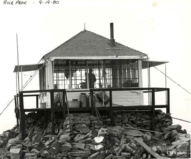
Rice Peak is a former fire lookout site. The structure is still on the summit. Also see Boise National Forest Lookouts. USGS Rice Peak
Rice Peak in happier days. USFS Photo
Updated Access
FS-478 temporary closure (which started in 2014) is evidently still in place. See this link to FS order: Closure Order
From Cascade, drive about 25.0 miles east on the Warm Lake Highway. At the Stolle Meadows sign, turn right onto FS-474. Go about 7.0 miles, then turn left onto FS-478. Go about 4.0 miles to the Rice Lake trailhead. The summit is 1.0 mile up the Rice Peak Trail.
Additional Resources
Regions: Log Mountain - Deadwood Divide Peaks->Salmon River Mountains->WESTERN IDAHO->Western Salmon River Mountains
Mountain Range: Western Salmon River Mountains
Longitude: -115.62779 Latitude: 44.50679