Elevation: 7,320 ft
Prominence: 80

This peak is not in the book. Published November 2024
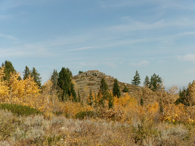
Rocky Peak is aptly named. It sits a short distance due north of Pine Creek Pass in the southern extremities of the Big Hole Mountains. Rocky Peak is most easily climbed from the Great Western Trail/FST-230 which comes up from ID-31 about two miles east of Pine Creek Pass. USGS Fourth of July Peak
Access
From Swan Valley, Idaho, drive northeast up ID-31 to Pine Creek Summit. Continue east on ID-31 for about 0.6 miles to the Pine Creek Campground. Park either in the campground or in a pullout at the mouth of a drainage on the north side of ID-31 just west of the campground entrance.
Map Errors
The USGS topo map fails to show FST-230/Great Western Trail coming northwest up from ID-31, skirting Point 7308, and continuing northwest up to the primary north-south summit ridge. Maps fail to show the decent use trail coming up the primary north-south ridge from Pine Creek Pass. Both of these trails are useful in reaching Rocky Peak.
South Face/East Ridge, Class 2
The Climb
From the Pine Creek Campground, cross to the north side of ID-31. Bushwhack northeast up through a thick forest of pines and aspens, with a fair amount of understory. Reach open scrub terrain above the forest. Scramble north up the left/west side of a rounded shoulder in thick-ish sagebrush to reach the east ridge and well-beaten FST-230. Follow FST-230 left/west as it skirts the left/south side of a ridge hump then climbs west to barely skirt the left/south side of Point 7308.
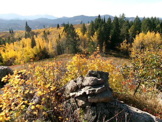
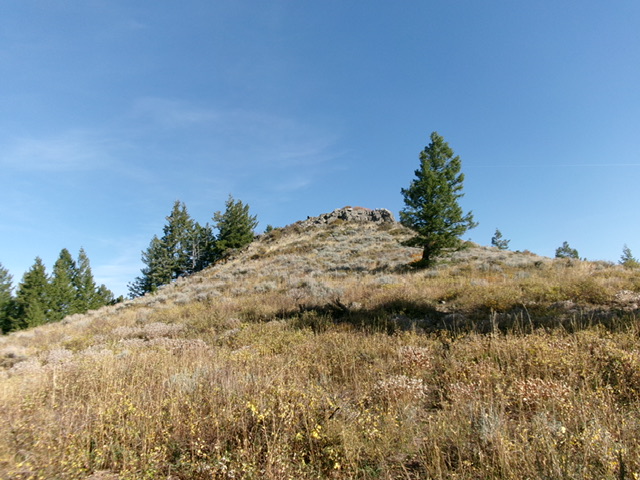
Leave the trail and bushwhack right/north a short distance in sagebrush to reach the open top of Point 7308. From Point 7308, follow a good use trail north through a patch of pine forest and 50 vertical feet down to an open saddle. From the saddle, head northeast on an overgrown, weak use trail through thick-ish sagebrush to reach the rocky summit of Rocky Peak. Stand atop several different boulders to be sure that you stood on the highest point. I built a decent cairn atop the highest boulder, in my opinion. Rocky Peak stands out because it is so rocky, unlike its scrub-hill neighbors.

The newly-built summit cairn atop Rocky Peak with Point 7308 in the distance (in mid-ground). Livingston Douglas Photo
South Shoulder, Class 2
The Descent
From the summit, return over Point 7308 back to FST-230. Follow FST-230 east briefly to the west side of an obvious, large gully. Leave the trail and descend southeast then south in thick-ish scrub on a rounded shoulder. Stay left/east of a patch of aspens. Descend the left/east side of the shoulder in open scrub until lower down, where a bushwhack through aspens and pines is necessary to return to ID-31. Finish the descent in a miserably thick, narrow, wet gully.
Cross a small stream and quickly find an old, grassy 2-track in the pine forest. Follow the 2-track briefly southeast to reach ID-31 a short distance west of the Pine Creek Campground. Return to your vehicle here at the outlet of this gully (if you parked at the base of this short 2-track road) or walk briefly left/southeast down the highway to the Pine Creek Campground and your awaiting vehicle.
Alternative Ascent Routes, Class 2
You can reach Rocky Peak with minimal bushwhacking via FST-230/Great Western Trail from about two miles east of Pine Creek Pass on ID-31. Follow the trail all the way to just below Point 7308. Bushwhack a short distance to Point 7308 then follow a use trail almost all the way to the top of Rocky Peak. This is a much longer hike with more elevation gain than my shorter routes. Alternatively, you can reach Rocky Peak by hiking north then northwest up a use trail from Pine Creek Pass. Leave the trail in open terrain at about 7,280 feet and contour over to Point 7308 in open scrub then follow the use trail to near the summit of Rocky Peak.
Additional Resources
Mountain Range: Big Hole and Snake River Mountains
Longitude: -111.2108 Latitude: 43.5839

