Elevation: 6,471 ft
Prominence: 451

This peak is not in the book. Published December 2024
Rocky Peak is a misnomer. This peak is not rocky at all. It is entirely on private land. Pacificorp owns most of the land surrounding Oneida Narrows Reservoir and allows hiking on their private land. It is unclear if Rocky Peak is on Pacificorp land or not, but I encountered no signage or fencing prohibiting entry. USGS Treasureton

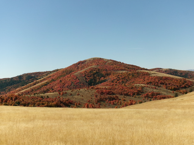
Rocky Peak as viewed from the northeast. The east face is the slope left of center and was my descent route. Livingston Douglas Photo
Access
Same as for Cleveland Hill (6,478 feet). This is the second leg of a 2-peak adventure that includes Cleveland Hill and Rocky Peak (6,471 feet). It covers 7.0 miles with 2,350 feet of elevation gain round trip.
Map Errors
There are numerous 2-track roads on both Cleveland Hill and Rocky Peak that are not shown on the USGS topo map or the Caribou-Targhee National Forest Map.
East Spur/North Ridge, Class 2
The Climb
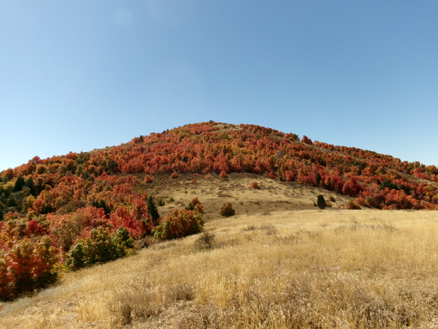
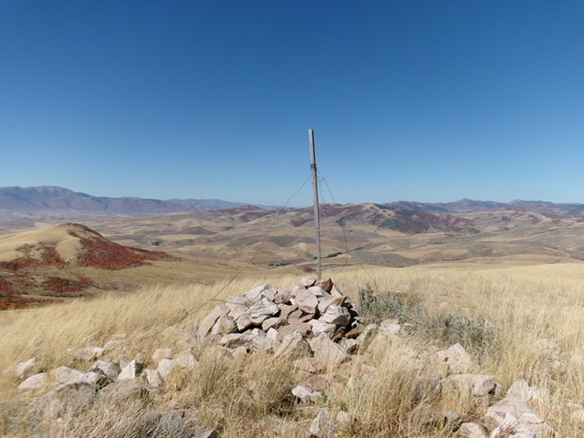
From the road junction at 6,040 feet, bushwhack briefly south to gain the east spur of the north ridge of Rocky Peak just east of Point 6076. Follow an old cattle trail in the ridge grass west then southwest through a patch of thick maples to gain the crest of the semi-open north ridge. Scramble south up the grass on the north ridge to reach a final, thick patch of maples. The maples are the crux of the climb. Work upward through this somewhat tedious (but not awful) section to reach open grass high up. Head south up the easy grass to the well-cairned summit of Rocky Peak. The peak has no rocky sections nor a rocky summit cap.

The summit hump of Rocky Peak as viewed from high on the north ridge. This was my ascent route. Livingston Douglas Photo
East Face, Class 2
The Descent
From the summit, descend east in open grass that soon becomes a maple forest with hidden patches of grass. Try to stay on semi-open shoulders. Your aim is to reach the prominent gully that splits the east face. Much of this descent is on face terrain and is forested. The bushwhack down to the gully is not too bad, thanks to grassy patches and not much deadfall. The understory is thick, however. Look for an open, small meadow (of sorts) with an old, grassy road bed leading down into the prominent gully.
When you reach the old road bed, head left/north down it and quickly reach the gully. The gully heads east then northeast then southeast down to Bear River. The old road bed merges into a decent jeep road. Follow this good jeep road for a short distance to where it reaches a private cabin. Leave the road just before reaching the cabin and follow the remnants of a 2-track road down the left/north side of the narrow, thick gully. The old 2-track/road bed eventually disappears.
Follow weak cattle trails, grassy lanes, and open fields down to an old, grassy 2-track near Bear River. The USGS topo map shows a road heading west up the gully near its mouth but that road and any remnants of it are long gone. Follow this 2-track north briefly to reach the footbridge crossing of Bear River. Cross the footbridge to return to the large parking area and your vehicle.
Additional Resources
Regions: Portneuf Range->SOUTHERN IDAHO
Mountain Range: Portneuf Range
Longitude: -111.7844 Latitude: 42.2575
