Elevation: 10,726 ft
Prominence: 534
Climbing and access information for this peak is on Page 268 of the book. The book details the original route climbed by Baugher and Ferguson in 1995. My 2003 route up the west ridge is discussed below. You will also find a GPS track from 2018. Livingston Douglas provided new access point, the initial section of ascent route, and more detail on the upper part of the ascent route. He also has provided a new descent route, which includes the difficult, Class 4 traverse to Corner Shot Peak. Livingston also gave us additional photos showing the peak from a seldom-seen perspective. The peak’s elevation and prominence figures are now updated with the new LiDAR estimates. Updated November 2024
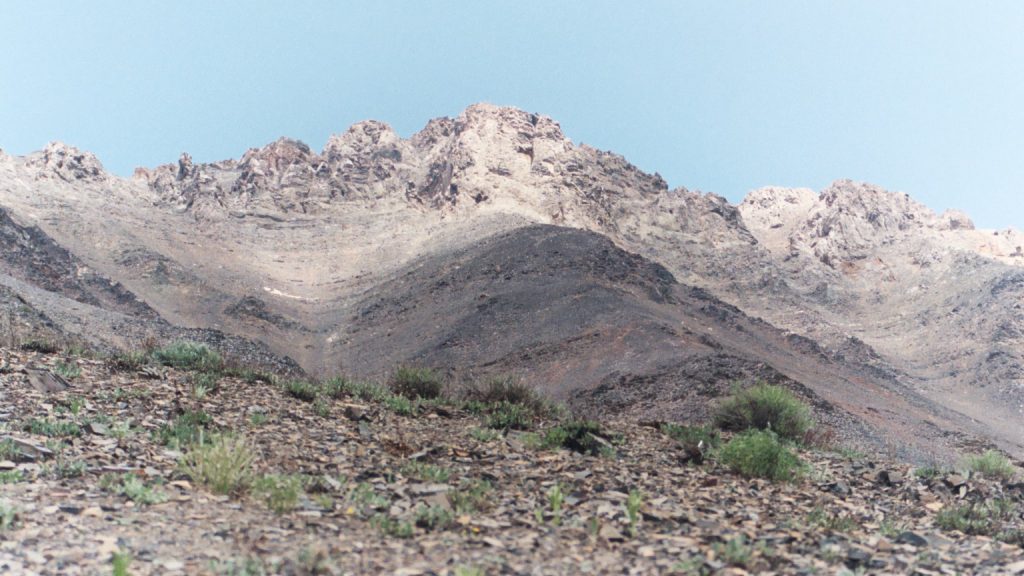
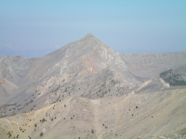
Straight Shot Peak is a quintessential Pahsimeroi summit that combines a steep ridge approach with a nice scramble over the upper cliffs. USGS Grouse Creek Mountain
Access for West Ridge Route
This ridge is accessed from Arentson Gulch [(B)(4) on Page 292].
West Ridge, Class 3+
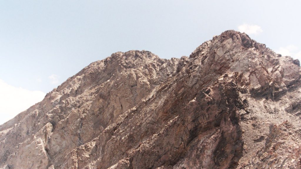
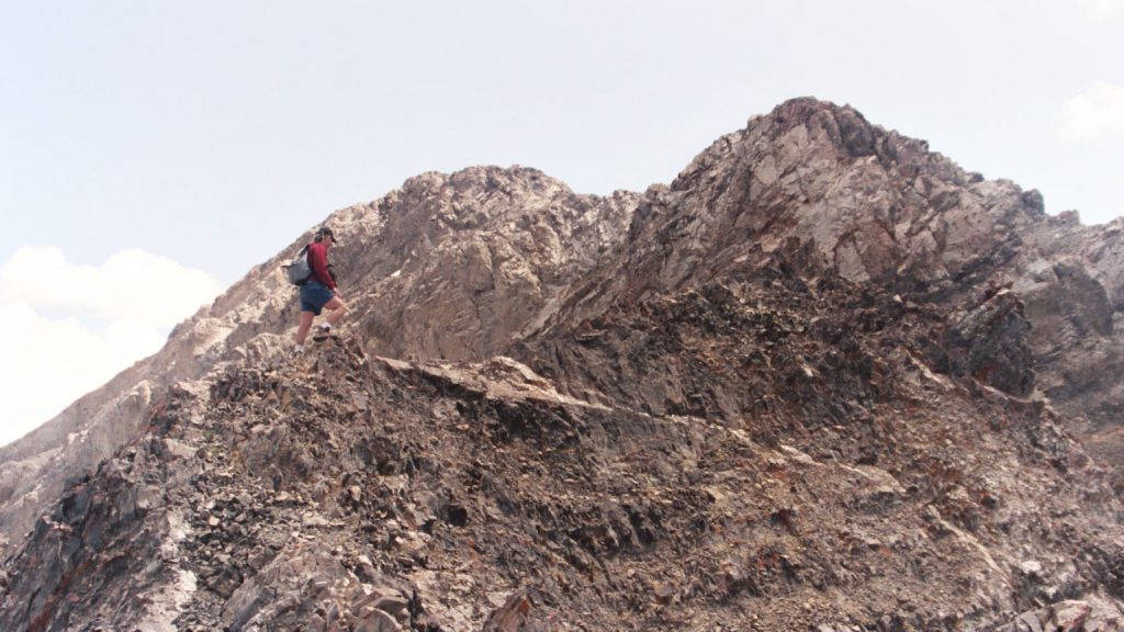
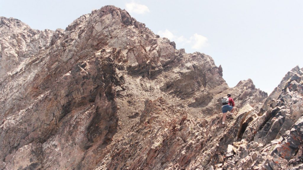
The west ridge forks as it descends from the summit to Arentson Gulch. Start the climb on the southernmost fork and continue up to the spot where the two forks merge at roughly 9,200 feet. From this point, the route is above tree line and the ridge becomes a series of cliffs and towers composed of broken rock. As the photos below demonstrate, navigating the upper ridge takes time and patience.
Southwest Ridge/West Ridge and Southeast Face/Southeast Ridge by Livingston Douglas
This is the first leg of a 2-peak adventure that includes Straight Shot Peak and Corner Shot Peak (10,913 feet). It covers 6.0 miles with 4,200 feet of elevation gain round trip.
Access
Arentson Gulch Road [(B)(4) on Page 292 of the Book]. Here are more specific driving details. From US-93 northwest of Mackay at virtual MM135.9, turn right/east onto [signed] Arentson Gulch Road. Reset your odometer here. At 0.4 miles, the road reaches an unsigned junction at a cattle fence/gate. Turn left/north here and go through the cattle gate. At 1.9 miles, go through a second cattle gate. At 3.4 miles, reach an unsigned road junction. A short spur road goes left.
Continue straight here on Arentson Gulch Road. The road turns to dirt and gets a bit rougher here. At 3.5 miles, reach the [signed] Challis National Forest boundary. At 3.6 miles, reach a fork in the road. Go right/northeast here onto a spur road that heads up into a side gulch. At 4.0 miles, reach a cattle cistern and a forested campsite. At 4.4 miles, reach an unsigned road junction and a fork in the gulch. Park here (7,815 feet and 44⁰15’00”N, 113⁰54’24”W).
Map Errors and Website Corrections
The USGS map fails to show the full extent of the 2-track heading northeast then east up a side gulch and away from Arentson Gulch. This grassy, narrow 2-track continues about 0.4 miles from the cattle cistern (where the USGS topo map shows the road’s end) to an unsigned junction. It continues another 0.2 miles to its end in the forested, left fork of the side gulch. Maps show Arentson Gulch Road as a 4WD road when, in fact, it is pretty smooth and decent (gravel base) 2-track road for its first 3.5 miles.
Southwest Ridge/West Ridge, Class 4
The Climb
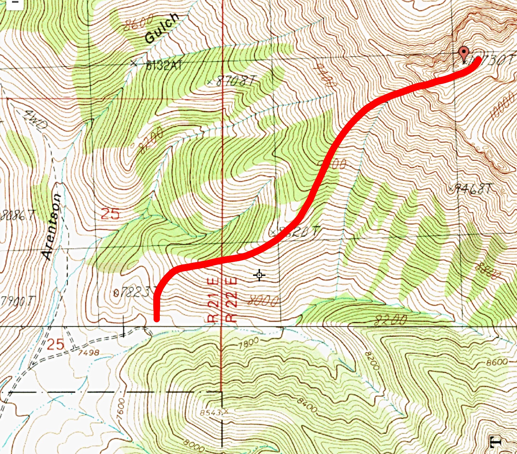
If you plan to climb both Straight Shot Peak and Corner Shot Peak together, it makes sense to drive up to this unsigned junction in order to cut down on the roundtrip mileage. The 2-track side road up the side gulch is narrow and somewhat overgrown, but is not too bad. From the unsigned junction,scramble north up a STEEP scrub shoulder that is better defined than the USGS topo map indicates. Stay on the ridge crest in open rock (loose scree/gravel) and away from the thick sagebrush on the sides of the ridge. Higher up, gapped sagebrush takes over, even on the ridge crest.
Reach the crest of the southwest ridge just below Point 8620. The ridge is open scrub here and has remnants of an unmapped old 2-track on or just left/west of the ridge crest. The old grassy 2-track soon ends and forest takes over. The ridge steepens and becomes very loose gravel. Above tree line, the ridge narrows and steepens even more. Stay on the ridge crest and use goat trails and embedded rock for better footing. Higher up, minor rocky outcrops begin (and help with footing). The gravel turns to talus/scree. Stay on this Class 2+/3 ridge all the way to its top, where it meets the crest of the west ridge.
The west ridge is a brutal mess of awful ridge towers and fierce exposure. I climbed briefly on its Class 4 knife edges and then dropped off it to skirt below the impossible, endless towers on their right/south then southwest sides. Surprisingly, this is easy going on goat trails in angled scree in large gullies. The arete crossings are easy and never cliffed out. Keep moving eastward underneath, and well below, the ridge towers until you can see the easy, open southeast ridge to your left/east. Scramble left/north here up steep-ish scree and ground rock to regain the crest of the west ridge high up. Follow the [now-easy] rocky ridge right/east-northeast over two or three false summit humps to reach the true summit of Straight Shot Peak. The summit has a decent cairn.
Southeast Face/Southeast Ridge, Class 4
The Descent
This descent route goes all the way to the gentle, 9,900-foot connecting saddle with Corner Shot Peak (10,913 feet). Most of this descent is Class 2/2+. However, there is a serious obstruction in the middle of the ridge traverse to the saddle. That rocky mess goes at Class 4.
From the summit, head briefly southwest on the ridge crest then descend steep, loose talus/scree on the southeast face and angle over to the southeast ridge. Reach a gentle, gravelly area just above the imposing ridge towers/buttresses that must be navigated in order to reach the connecting saddle with Corner Shot Peak. Once on the southeast ridge, climb up and over an initial tower that has an exposed, wicked knife edge (Class 4) that must be straddled and downclimbed to a narrow notch.
From the notch, scramble southeast up then across the Class 3 ridge crest of the massive ridge buttress on the southeast ridge. Cross over the top of this surprisingly-easy buttress. Do not even think about attempting to skirt this buttress on its left/northeast side on very steep slab rock. From the top of the buttress, descend Class 3 rock and ledges to reach two final ridge towers. Skirt these impossible towers via a scree chute on their right/southwest side.
Emerge in easy, open scree on the right/southwest side of the ridge crest. Follow a diagonal goat trail back up onto the ridge crest and cruise southeast on easy, broken rock to Point 10025. From Point 10025, descend southeast on easy, broken rock and tundra to quickly reach the wide, gentle connecting saddle with Corner Shot Peak at 9,900 feet. This saddle is the terminus of the first leg of today’s 2-peak journey. Corner Shot Peak (10,913 feet) is up next. Just another thousand feet of uphill to go.
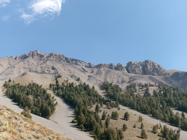
The steep, forest-and-rock, shoulder-and-gully aspects of the southwest face of Straight Shot Peak. The difficult, gapped, rocky lower section of the connecting ridge with Corner Shot Peak is right of center. Livingston Douglas Photo
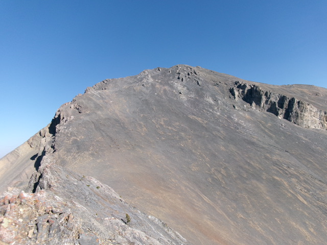
The southeast face of Straight Shot Peak. The summit is in dead center. This steep, gravelly section was the first leg of my descent. Livingston Douglas Photo
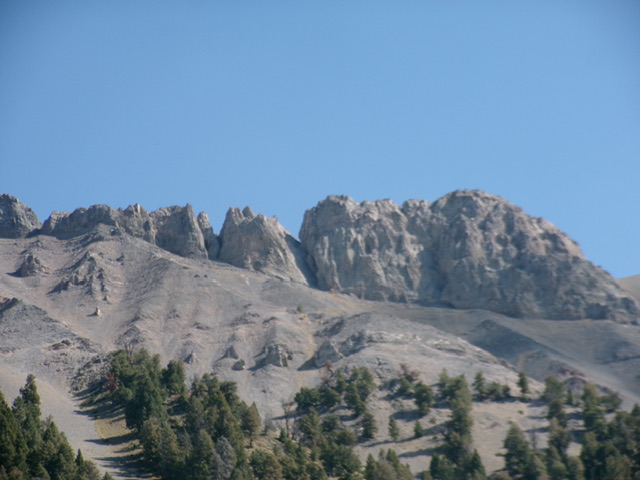
The profile of the knife-edged, exposed Class 4 section of the Straight Shot/Corner Shot traverse. Livingston Douglas Photo
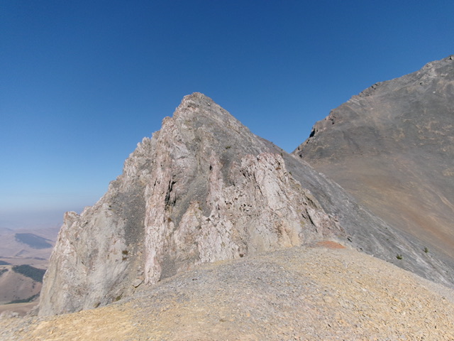
The southeast side of the final ridge buttress that must be downclimbed to reach safer ground and the connecting saddle with Corner Shot Peak. Livingston Douglas Photo
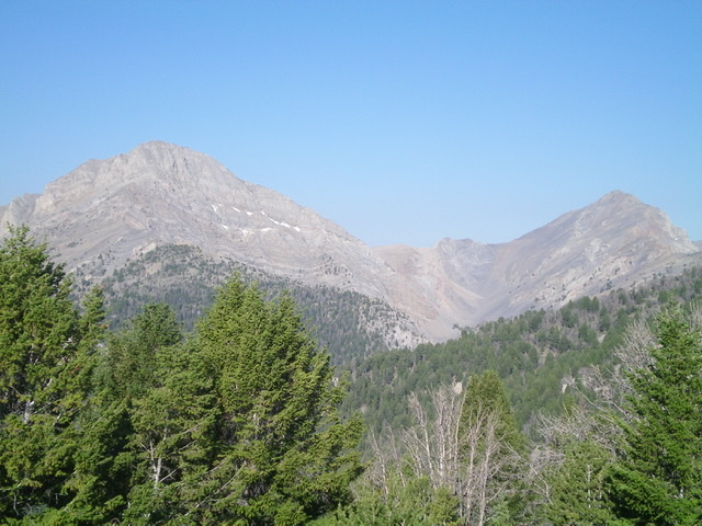
Straight Shot Peak (right) and Corner Shot Peak (left) as viewed from the east. Livingston Douglas Photo
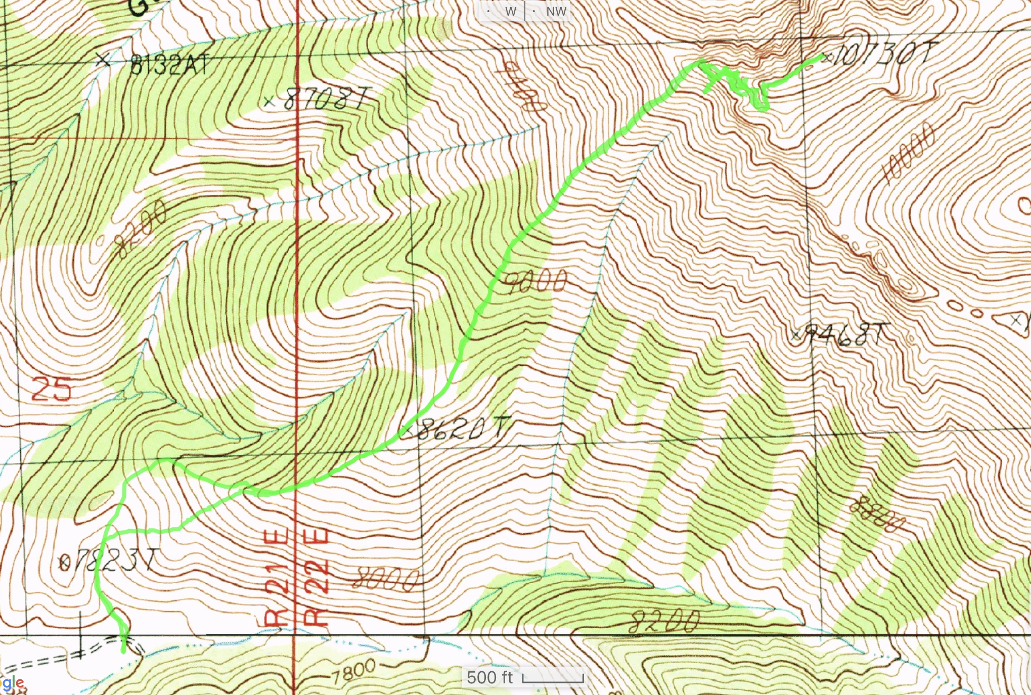
Brett Sergenian GPS Track
Additional Resources
Regions: EASTERN IDAHO->Lost River Range->Pahsimeroi Range
Mountain Range: Lost River Range
Year Climbed: 2003
First Ascent Information:
- First Ascent Year: 1995
- Season: Fall
- Route: East Headwall/South Ridge
- Party: Rick Baugher and Charles Ferguson
- Other First Ascent: West Ridge
- Year: 2003
- Season: Summer
- Party: Tom Lopez and Basil Service
Longitude: -113.89401 Latitude: 44.26289
