Elevation: 6,854 ft
Prominence: 394

This peak is not in the book. Published December 2024
Swan Benchmark is located on a high ridge just southeast of Malad Summit. This ridge separates Devil Creek from Cherry Creek. Peak 7060 to its south-southeast is the high point on this ridge. This area is a mix of public land and posted, private land so be careful. This climb is entirely on National Forest land. USGS Malad Summit

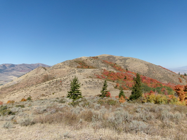
Swan Benchmark as viewed from the south. This was the final leg of my ascent route. Livingston Douglas Photo
Access
From US-91 at the south end of Downey, turn right/southwest onto [signed] Malad Highway (later signed as “Old Malad Highway”) at virtual MM36.6. At 2.1 miles, just after a bridge crossing, turn left/south onto [signed] Cherry Creek Road and reset your odometer. At 5.5 miles, enter the Caribou National Forest at a cattle guard crossing. Park just below the cattle guard in a spacious pullout area (5,415 feet and 42⁰19’43”N, 112⁰08’56”W).
South Ridge, Class 2
The Climb
From just inside the National Forest boundary on Cherry Creek Road, descend a cattle trail for 30 vertical feet to cross Cherry Creek. Follow the good trail right-ish to reach the fence row that separates National Forest land from posted, private ranch land. This fence row heads left/west. Follow a cattle trail on the left/south side of the fence row as it crosses a shoulder, drops to cross a forested gully and then climbs up over another shoulder.
Leave the fence row on this second shoulder and scramble left/south then southwest up a mostly-open shoulder of grass/scrub. This shoulder has game/cattle trails and only patches of forest, so it goes pretty quickly. There are a few short patches of maples and understory to bash through and some willows high up. The shoulder leads up to Point 6869 on the high ridge crest south-southeast of Swan Benchmark. From Point 6869, the ridge traverse to Swan Benchmark goes pretty quickly. The terrain is a mix of mostly open scrub with a patch of pine forest early on (not a difficult bushwhack).
There is a patch of thick scrub to bash through early on. Once you reach the 6,460-foot connecting saddle with Swan Benchmark, it is a cruise up open grass and scrub to the summit. Stay to the left/west of the ridge crest for the easiest, most-open going. The summit of Swan Benchmarks is a bare ridge hump with triangulation station wreckage on top but no summit cairn. I built a summit cairn and stuck a triangulation post in it.

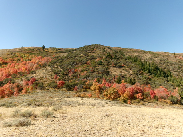
Swan Benchmark (dead center) and its forested northeast face. This was my descent route. Livingston Douglas Photo
Northeast Face, Class 2
The Descent
From the summit, descend east-northeast in mountain mahogany (not too bad) then patches of open grass/scrub, all on a decent high ridge. Things soon become much thicker and the terrain becomes much more of a face with a lot more maple forest and dense understory to contend with. Head northeast and look for the east-west fence row that separates National Forest land from private ranch land. It is quite visible from above.
Follow cattle/game trails to approach the fence row. Bash through a final, thick patch of forest to reach it. Once at the fence row, follow a cattle trail on its right/south side to return to Cherry Creek and then up to Cherry Creek Road and the National Forest Boundary.
Additional Resources
Regions: Bannock Range->SOUTHERN IDAHO
Mountain Range: Bannock Range
Longitude: -111.1771 Latitude: 42.3279
