Elevation: 11,015 ft
Prominence: 536
Climbing and access information for this peak is on Page 308 of the book. The book recommends climbing Rick Baugher’s East Ridge Route. After talking about the route, I think this route is more appropriately called the East Rib Route since the line does not follow a highly-defined ridge. The elevation and prominence figures are updated and based on LiDAR calculations. Livingston Douglas provides the detailed route information. Updated March 2025
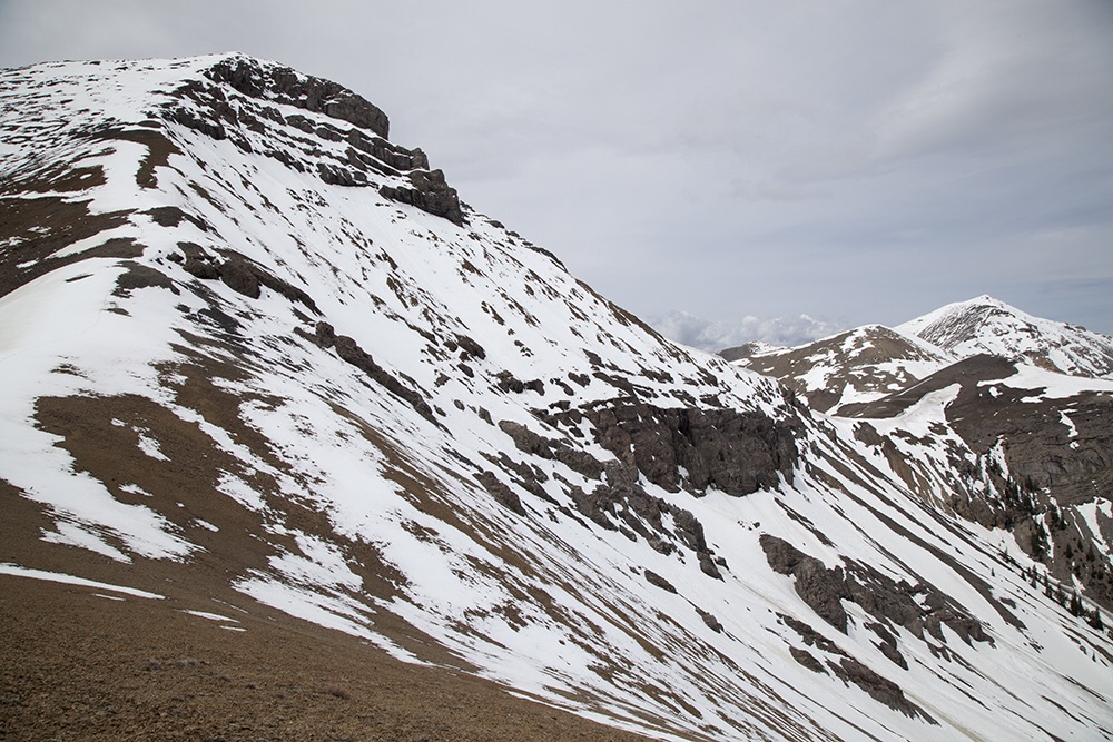
The Brow is the lowest of Idaho’s 11ers. It is the first summit north of Diamond Peak on the main Lemhi crest and its distinctive summit is a beauty. See Larry Prescott’s trip report (linked below) for additional photos. USGS Diamond Peak
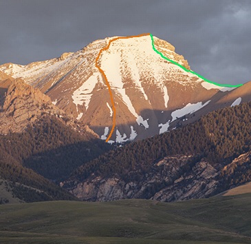
The north face of the Brow. Larry Prescott Photo
Livingston Douglas Update
Access
North Fork Pass Creek [(A)(2) on Page 313 of the book]. Same as for Dyer Mountain. This is the final leg of a 3-peak adventure that includes Dyer Mountain (10,387 feet), Lame Jake Peak (10,817 feet), and The Brow.
Northeast Ridge, Class 2
The Climb
From the narrow 10,140-foot connecting saddle with Lame Jake Peak, scramble southwest up a rounded ridge that becomes better defined as you approach the summit. The terrain is awful, loose shale but there is a climber’s trail to assist in your endeavor. The summit of The Brow is a crumbly mess. I built up the small summit cairn. The summit offers a magnificent view of nearby Diamond Peak (12,200 feet).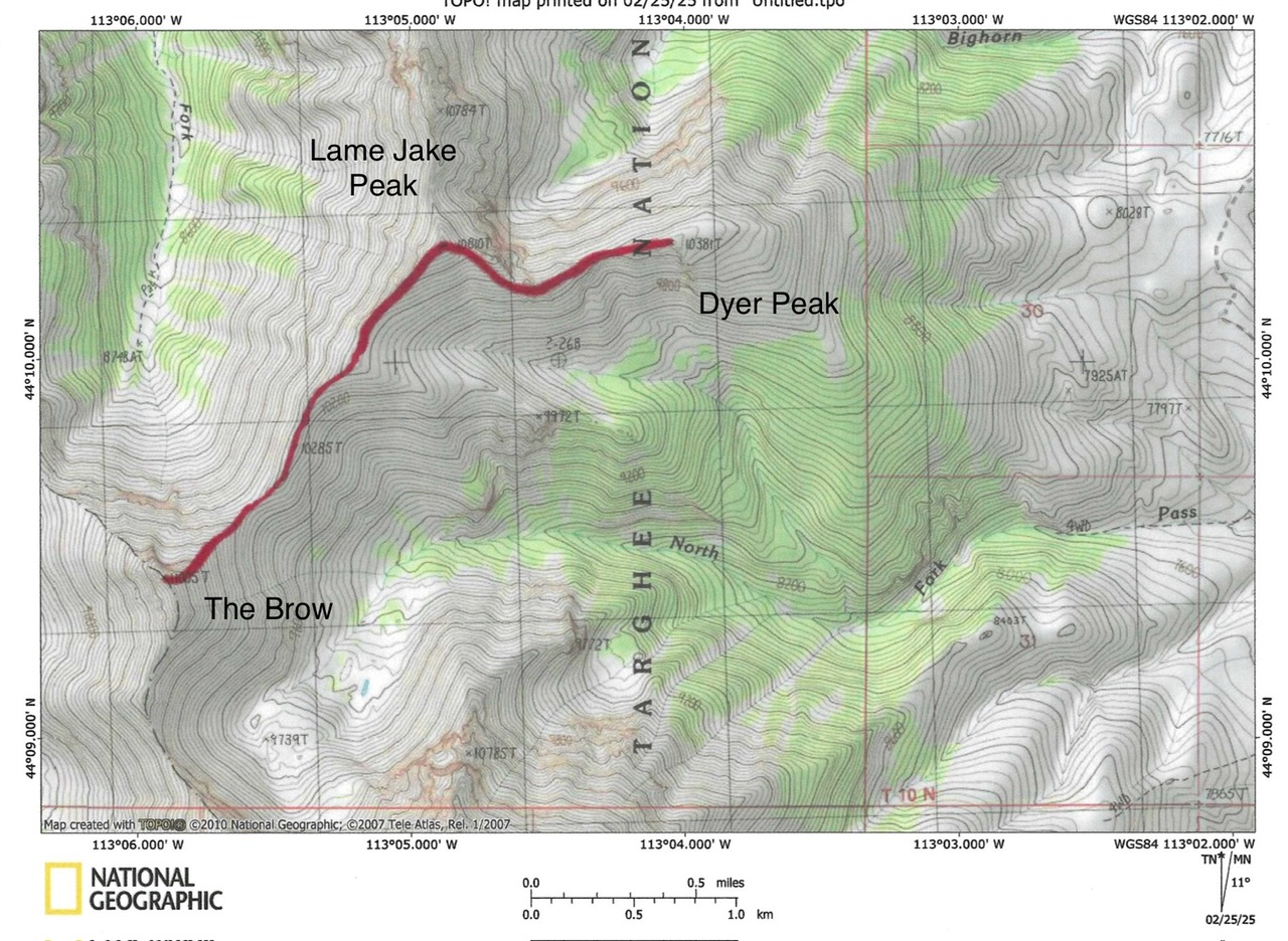
Larry Prescott Update
This photo shows Larry’s route up the East Rib and descent down to the ridge leading to Lame Jake Peak. Larry Prescott Photo
2015 Update by Larry Prescott
The drive to North Fork Pass Creek was straightforward [(A)(2.1) on Page 313]. The road was excellent by Lemhi standards. My Forester had no problem at all. The most important turnoff comes shortly after turning onto Pass Creek Road from the highway. Not long after turning, look for a road on the right that takes you up a small bench. Once on this road, follow it until you see the mouth of North Fork Pass Creek Canyon. It is quite a distance.
The hike up the canyon was beautiful. Springs emerged from several places to feed the creek. They often disappeared and reemerged alone the way. A nice bonus of such a hike is drinking straight from icy-cold mountain spring water. As I neared the end of the canyon, I veered left. I could not get a good look at the mountain because of the trees. From what I could see and from looking at the face from the Birch Creek Valley earlier in the morning, I had pretty much decided on a line up the East Face towards the south end. I also planned on coming down the East Face on the north end to make the ridge leading to Lame Jake Peak.
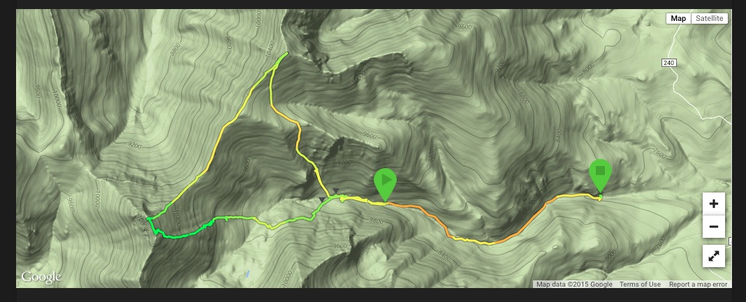
Larry’s GPS track for his ascent of The Brow
Additional Resources
Regions: EASTERN IDAHO->Lemhi Range
Mountain Range: Lemhi Range
Longitude: -113.09829 Latitude: 44.15709