Elevation: 7,700 ft
Prominence: 80

This formation is not in the book. Published November 2024
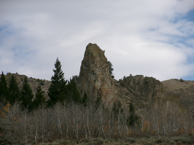
The Needles is a rocky outcrop that sits above the headwaters of Leadbelt Creek in the Pioneer Mountains. Its first recorded ascent was in 2024. Based on my visual observations, The Needles appears to be a Class 5 endeavor. It is most easily climbed from Leadbelt Creek Road. USGS Blizzard Mountain North
Access
Antelope Creek Road [(D) on Page 260 of the Book]. From US-93 about 10.5 miles north of Arco, turn left/west onto [signed] Antelope Creek Road and reset your odometer. At 4.0 miles, the pavement ends. At 18.1 miles, reach a signed turnoff for the Antelope Guard Station (right). Continue straight on Antelope Creek Road, heading toward the Iron Bog Campground. At 21.2 miles, just after a bridge crossing of Antelope Creek, reach a signed junction with Leadbelt Creek Road/FSR-218.
Turn left/east onto FSR-218 and reset your odometer. You will need a 4WD vehicle with good tires from this point. At 1.3 miles, reach a flat meadow. The 2-track road gets rougher after this meadow. At 2.9 miles, the road reaches an unsigned junction. Go left/southeast here and cross to the east side of Leadbelt Creek (a small stream). The road then quickly reaches a signed junction with FSR-223. Go left/east onto FSR-223, which is a continuation of Leadbelt Creek Road.
The road gets even rougher from here. At 4.3 miles, reach an unsigned road junction at a major fork in the canyon. Park at this junction (7,160 feet and 43⁰35’53”N, 113⁰40’06”W). LeadbeltCreek Road is a narrow, rough 4WD road with some bad ruts, a lot of bumpy ground rock, and a few steep sections.
Map Errors
The USGS topo map shows a 4WD road heading northeast from the final junction/parking spot up to the connecting saddle between Peak 8621 and Peak 8729. In fact, the rugged old road only goes a short distance and ends. It turns into a cattle/use trail and the road bed is completely gone.
The Approach and Climb, Class 5
From the road junction, follow an old jeep track northeast up to its end shortly after an unsigned junction with a side road that heads right/south up to an old mine. Leave the main road here (or shortly above this point on a cattle trail) and scramble north then northwest to reach the base of the east side of the summit cliffs. Choose a line on either the east, north, or west side to reach the airy summit. Of the two rocky outcrops, the southern one is the high point.
Additional Resources
Regions: EASTERN IDAHO->Pioneer Mountains
Mountain Range: Pioneer Mountains
Longitude: -113.6655 Latitude: 43.6034

