Elevation: 10,110 ft
Prominence: 250
Climbing and access information for this peak is on Page 210 of the book. Livingston Douglas contributed the updated route description set out below. Updated December 2021
Titus Peak is smaller than its neighbors Bromaghin Peak and Saviers Peak and is often climbed as part of a ridge run from Galena Summit to Saviers Peak. USGS Galena
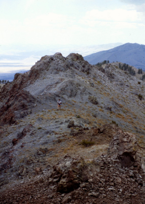
A climber on the summit ridge of Titus Peak, just below the high point.
Titus Peak by Livingston Douglas
Titus Peak is located on a high ridgeline in the Smoky Mountains that runs from Galena Summit south to Saviers Peak (10,441 feet).
Access
Same as for Titus Weather Station (9,921 feet).This is the third leg of a magnificent 5-peak ridge traverse that includes Titus Weather Station (9,921 feet), Lower Titus Peak (10,005 feet), Titus Peak, Bromaghin Peak (10,225 feet), and Saviers Peak (10,441 feet). The adventure covers 8.0 miles with 4,025 feet of elevation gainround trip.
Northwest Ridge, Class 2
The Climb
From the 9,780-foot connecting saddle with Lower Titus Peak, scramble southeast then south up the narrow ridge crest to the rocky summit of Titus Peak. The summit has a USGS benchmark and a triangulation post (with wiring) in a small cairn.
Southwest Ridge, Class 2
The Descent (then Ascent)
From the summit, descend south then southwest on the narrow,rocky ridge crest to quickly reach the elongated, 9,860-foot connecting saddle with Bromaghin Peak. This concludes the third leg of today’s 5-peak journey. Bromaghin Peak is up next.
Additional Resources
Regions: Smoky Mountains->WESTERN IDAHO
Mountain Range: Smoky Mountains
Year Climbed: 1987
Longitude: -114.71130 Latitude: 43.8360