Elevation: 6,030 ft
Prominence: 400
This butte is not in the book. Updated October 2025
Triplet Butte is located just west of the Bruneau River Canyon and a few miles north of the ID/NV state line. It sits at the northeast corner of Scott Table in a very remote area of southern Idaho. USGS Triplet Butte
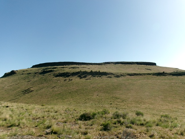
Triplet Butte as viewed from the southwest. This was my ascent route. Livingston Douglas Photo
Access
From ID-51 exactly 0.4 miles south of Grasmere, turn left onto [signed] Roland Road and reset your odometer. At 25.4 miles, reach the [unsigned] Totenkopf Junction. Go left at the road fork here. At 28.2 miles, reach an unsigned road junction. Bear left here. At 32.1 miles, reach a cattle guard crossing and a campsite. This is the Lower Trailhead. From the Lower Trailhead, the roads do NOT get much rougher, contrary to one writer’s comments.
The USGS topo map is remarkably accurate in showing the existing roads in this remote area, so carry that map with you. You can easily drive to the end of the 2-track road. It ends on Point 5764 but not all of this road is shown on the USGS topo map. I parked at a saddle underneath (and west of) Point 5802. You can walk the 2-track road from here easily [5,772 feet; 42°00’17.6”N, 115°40’29.7”W].
Map Errors
The USGS topo map shows a jeep trail heading north-northeast from Point 5802. That road no longer exists. The USGS topo map fails to show the 2-track road (at Point 5802) continuing around the north side of the point and then descending east to a saddle at 5,630 feet at the base of the south ridge of Triplet Butte then continuing up the ridge to just past Point 5764.
South Ridge, Class 2
The Climb
From the saddle just below (and west of) Point 5802, follow the 2-track road up as it continues northeast up and around Point 5802 then heads diagonally downhill and right/east to the 5,630-foot saddle (Saddle #1) at the base of the south ridge. Continue uphill on the 2-track until it ends just past Point 5764 on the east side of the north end of the narrow hump. From Point 5764, scramble north in easy grass and ground talus.
Descend right/northeast to Saddle #2 at 5,630 feet (coincidentally the same elevation as Saddle #1). From Saddle #2, head northeast up through an easy cliff band (the lower one) in field grass with a rockier, ground talus base. Continue left-ish/north-northeast to reach the obvious break in the summit cliff band (the upper cliff band). Scramble up an easy Class 2 chute with a series of man-made rock walls next to the chute. Hike up through the gap between the rock walls to reach the summit plateau.
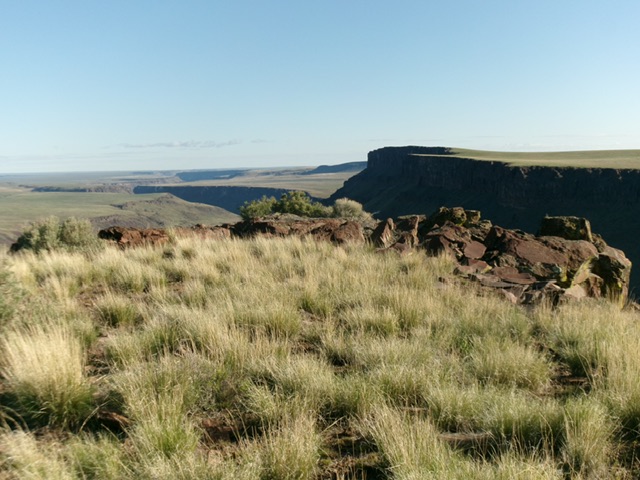
Once on the tilted summit plateau, head left/north to the northern tip, which is the high point of Triplet Butte. There is a large collection of large ground boulders here, but no summit cairn. The summit offers a stunning view to the north, looking down into Triplet Canyon.
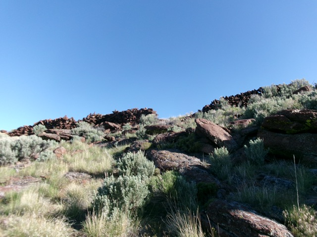
The rock walls at the entry point to the summit plateau. Livingston Douglas Photo
The summit boulders on the high point of Triplet Butte at its north end.
Additional Resources