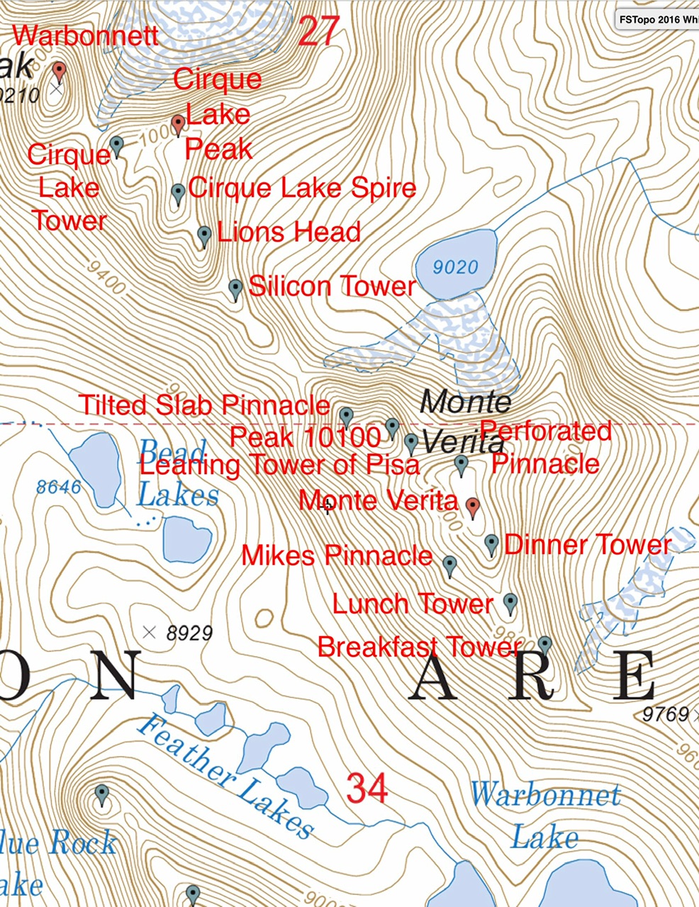
The exact location of several formations as been in question. Thankfully, Brian Westphal has determined through LiDAR analysis the exact elevation of the formations. Additionally, he researched the literature covering the climbing history of the ridge and pinned down the locations of the named formations. This page has been revised based on Brian’s findings. Based on his research the locations of Dinner Tower and Breakfast Tower have been switched and the location of Damocles has been pinned down. Read Brian’s comments at this link: Brian Westphal Reserach. Updated December 2025
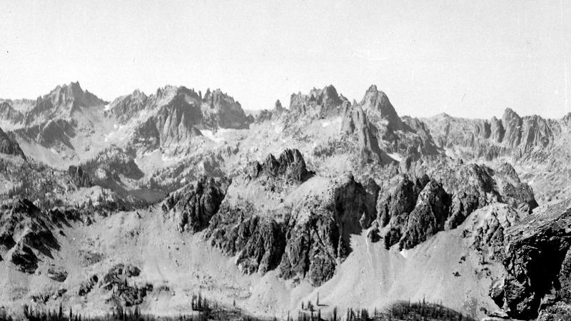
From the main Sawtooth crest near Alpine Lake an impressive ridge runs 5 miles northwest to Grandjean Peak. The section of the ridge between the main crest and Warbonnet Peak is cluttered with a complex collection of summits, spires, and towers composed of solid granite. These formations historically have received more attention by out of state mountaineers than any other single place in Idaho. The climbing heyday for this area was the early 1960s. This early attention is understandable because the complex is composed of solid granite forming a variety of challenging, enticing shapes. The ridge’s southern exposure (toward Goat Creek) is a steep mass of scree, talus, and hardpan. The north side of the ridge (which rises above Baron Creek) is generally composed of lovely, solid, high-angled slabs. All of the named formations were named by out of state climbers during this period. The best source of historical information for the named formations on Verita Ridge is the American Alpine Journal which can be searched online.
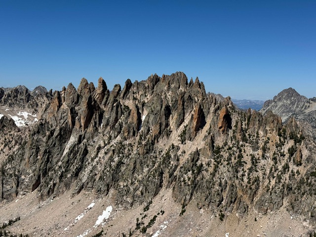
The Monte Verita massif is literally a maze of towers and faces most of which have not been tested. Derek Percoski Photo
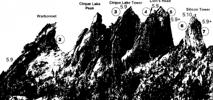
From northwest to southeast the named summits and formations are as follows: Warbonnet Peak, Cirque Lake Tower, Cirque Lake Peak, Cirque Lake Spire, Lions Head, Silicon Tower, Damocles, Tilted Slab Pinnacle, Leaning Tower of Pisa, Perforated Pinnacle, Monte Verita, Breakfast Tower, Mikes Pinnacle, Lunch Tower, Dinner Tower and Dessert Tower. These formations are discussed on Pages 186-190 in the book.

The Verita Ridge as viewed from the Cony Reward Divide. Warbonnet Peak (left) to Monte Verita. Blue Rock Dome, Rainy Day Pinnacle and The Mayan Temple are in the foreground starting in the center of the page. Bob Boyles Photo
Access
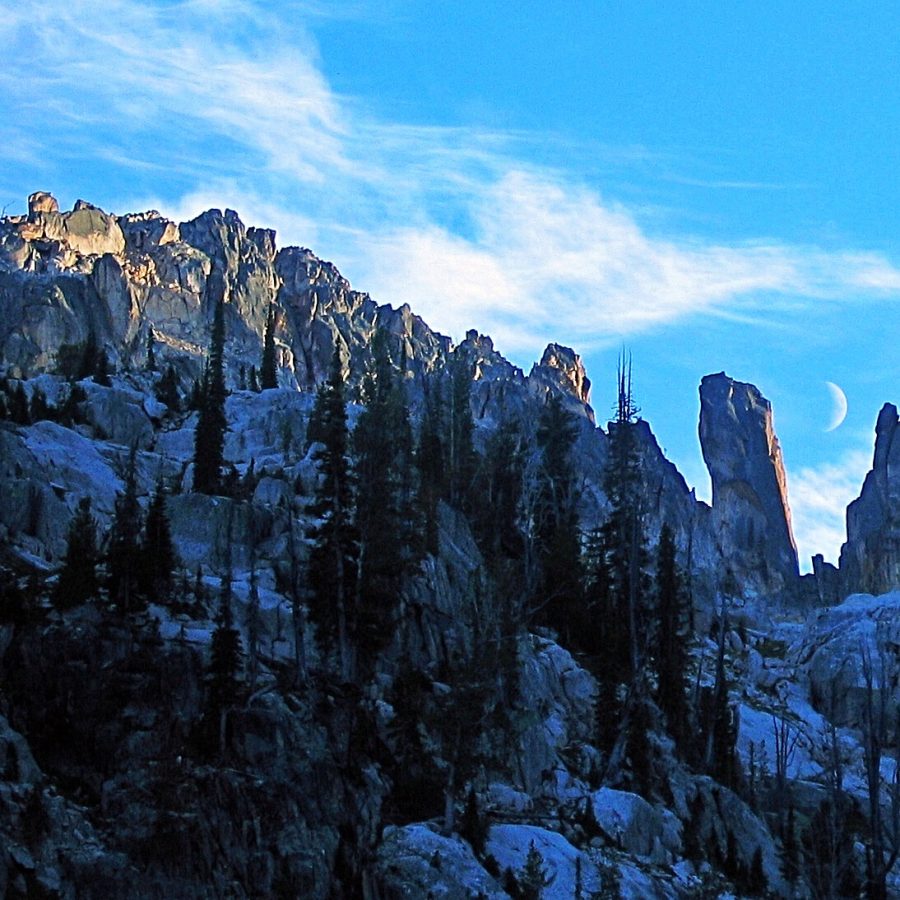
This photo is looking southeast along Verita Ridge from just below Silicon Tower. Ray Brooks Photo
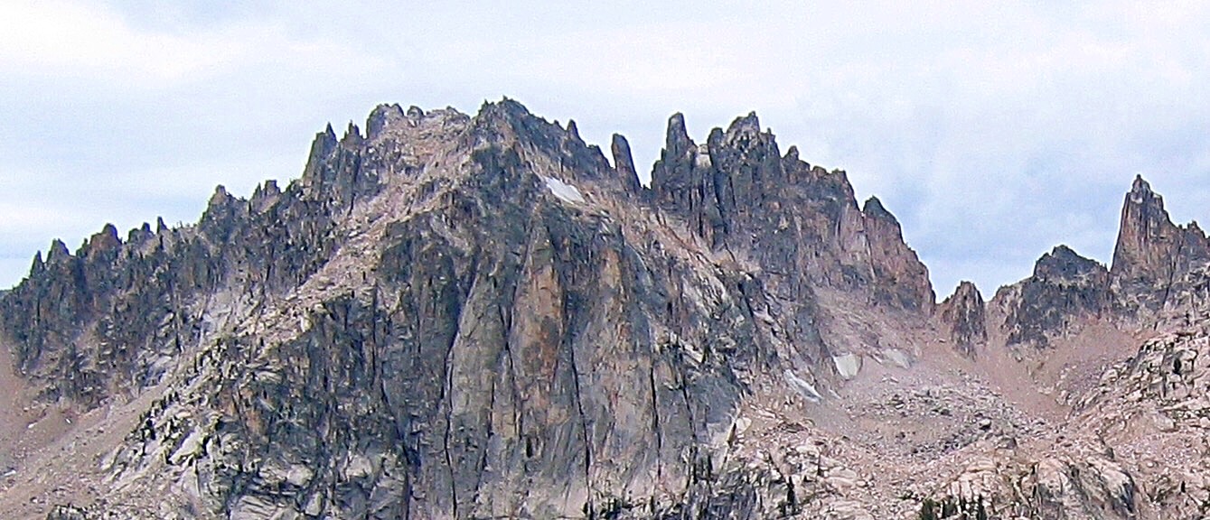
The section of the Verita Ridge Complex surrounding Peak 10100 and Monte Verita. Ray Brooks Photo
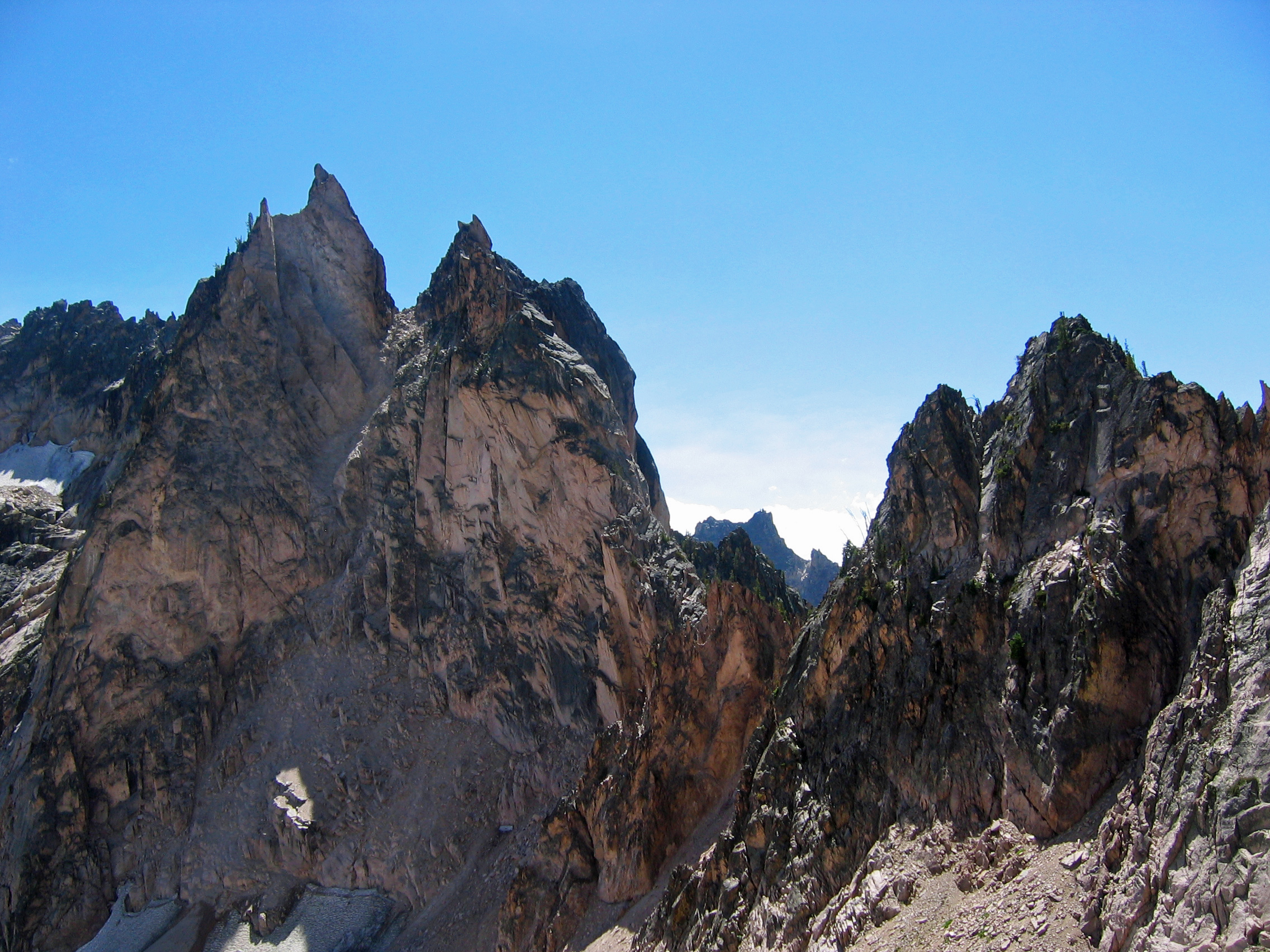
The Leaning Tower of Pisa. Ray Brooks Photo
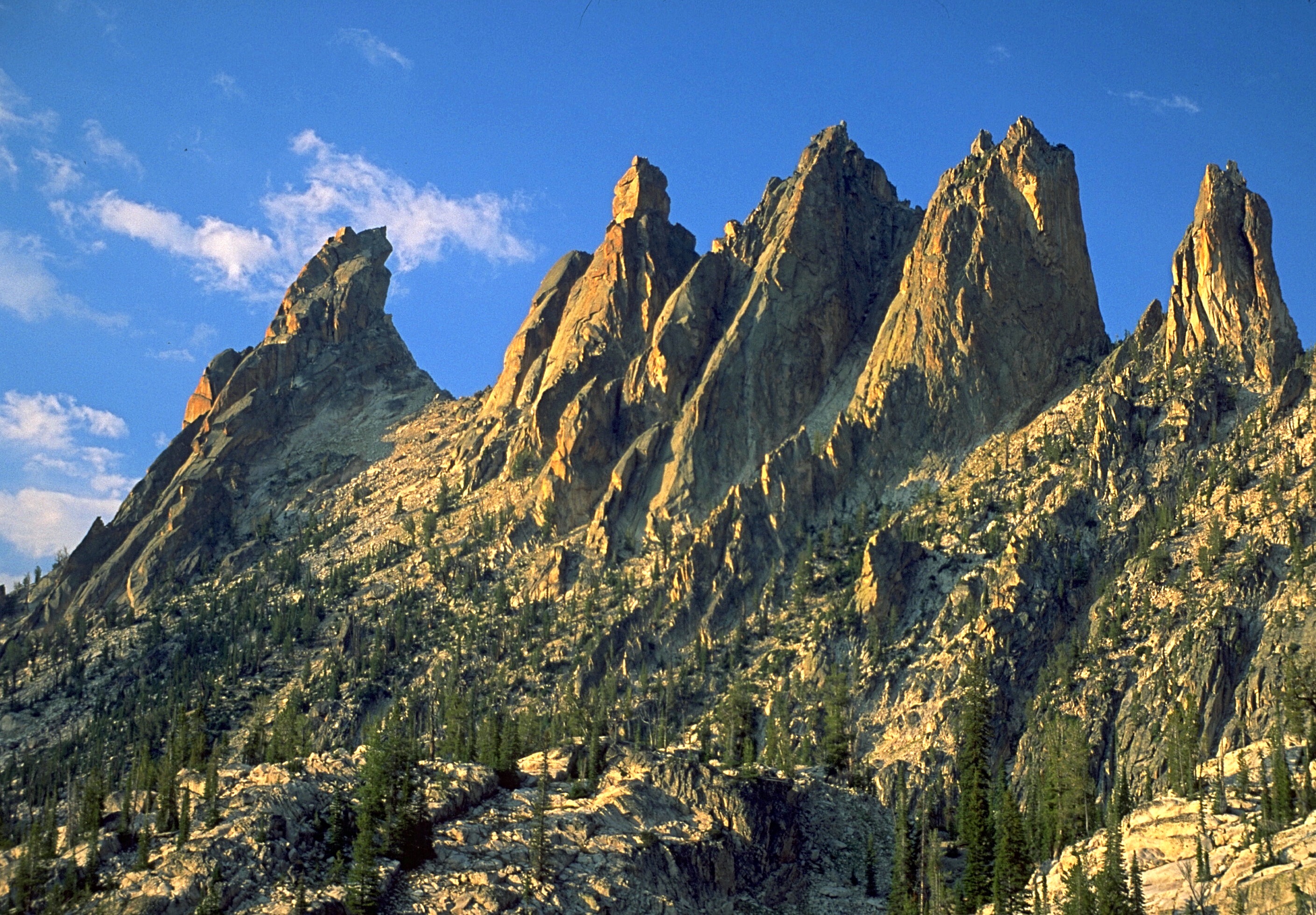
Peak 10100 with The Leaning Tower of Pisa on the right. Ray Brooks Photo
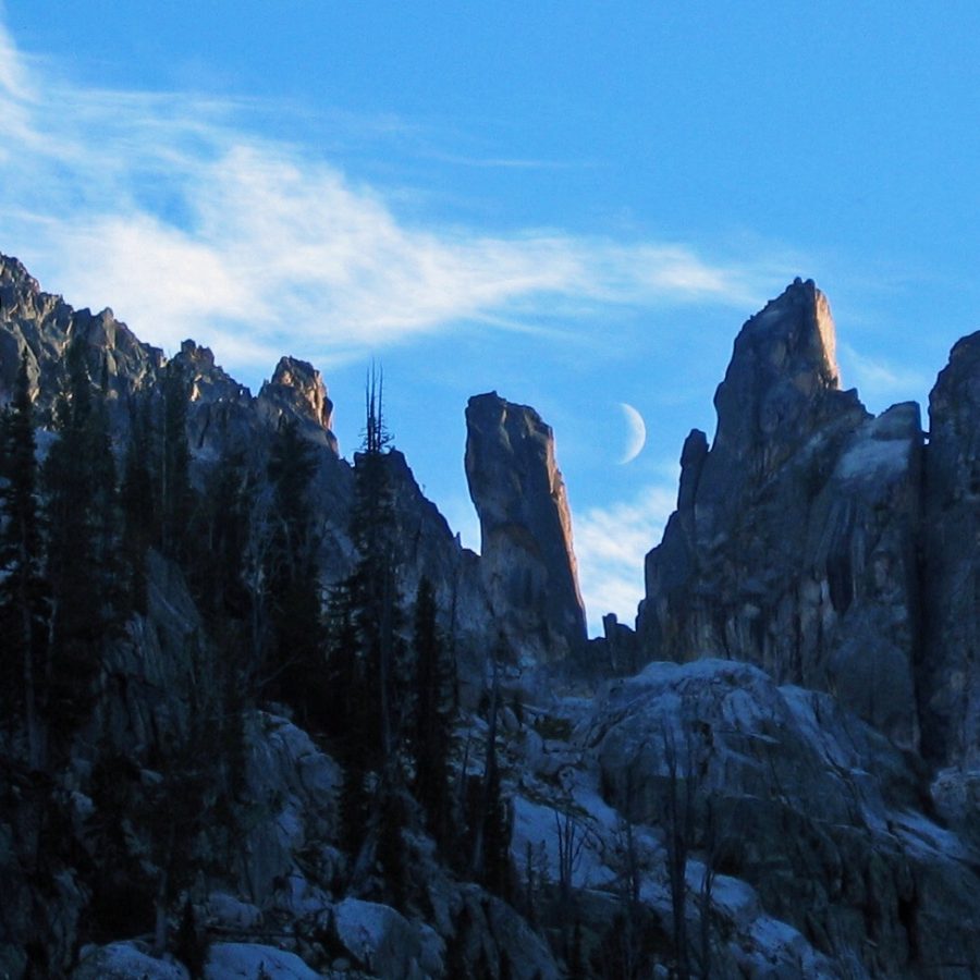
Warbonnet Peak (on the left) and its Verita Ridge neighbors are hidden from view deep in the Sawtooth Range. Ray Brooks Photo

Warbonnett Peak Viewed from Baron Peak.
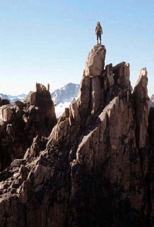
Harry posing on Verita Ridge. Ray Brooks Photo
A panorama from Packrat Peak on the left, Monte Verita and then Warbonnett Peak. Evilio Echevarria Photo
Verita Ridge. Provided by Clint Cummins
Regions: Sawtooth Range->Verita Ridge->WESTERN IDAHO
Mountain Range: Sawtooth Range