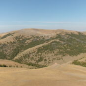
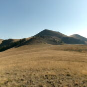
This peak is not in the book. Published November 2023 Peak 8100 is a forested, ridgeline hump that sits between the Pattee Creek drainage and the East Fork Kenney Creek drainage in the forested foothills of the west side of the Continental Divide northeast of Tendoy, Idaho. It is most easily reached from the Lewis and Clark Backcountry Byway, which … Continue reading
Search Results for: a cl

This peak is not in the book. LiDAR measurements have replaced the USGS quadrangle measurement of 9,965 feet. Updated November 2024 Peak 9965 is one of three high 9,000-foot peaks located above the Chamberlain Creek drainage (Peak 9911, Peak 9743, and Peak 9965). Peak 9965 sits west of the Continental Divide and is entirely within the State of Idaho. USGS … Continue reading

This peak is not in the book. Updated November 2024 Peak 9743 is one of three high 9,000-foot peaks located above the Chamberlain Creek drainage (Peak 9911, Peak 9743, and Peak 9965). Peak 9743 is on the Continental Divide and is the first ranked summit north of Peak 9911. It is most easily reached from the Eighteenmile Creek Trailhead. USGS … Continue reading

This peak is not in the book. Updated November 2024 Peak 9911 is one of three high 9,000-foot peaks located above the Chamberlain Creek drainage (Peak 9911, Peak 9743, and Peak 9965). Peak 9911 is on the Continental Divide and is the first ranked summit north of Cottonwood Benchmark (11,029 feet). It is most easily reached from the Eighteenmile Creek … Continue reading
This peak is not in the book. Published November 2023 Peak 9195 is located in the southern Beaverhead Mountains. It separates Blue Canyon to its south from Bear Wallow Canyon to its north. Peak 9195 sits northeast of Copper Mountain (10,303 feet) and is just east of the primary north-south Beaverhead Crest. USGS Copper Mountain Access From the junction of … Continue reading
This peak is not in the book. Published November 2023 Peak 7500 sits atop Horse Ridge on the east side of Chandler Canyon in the southern section of the Beaverhead Mountains. It is most easily reached by rugged, rutted Chandler Canyon Road. USGS Shamrock Gulch Access From the junction of ID-22/ID-28, drive east on ID-22 for 10.4 miles to [unsigned] … Continue reading