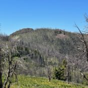
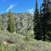
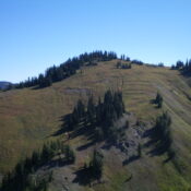
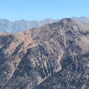
Peak 7924 by Livingston Douglas

This peak is not in the book. Published November 2022 Peak 7924 sits on the south side of Deer Creek. It separates Curran Gulch from Kinsey Creek. Peak 7924 is a ranked hump on the north ridge of Peak 8562. USGS Buttercup Mountain Access From Albertson’s at the north end of Hailey, drive north on ID-75 for 1.9 miles to … Continue reading

Bruneau Dunes HP by Livingston Douglas

This peak is not in the book. Published November 2022 Bruneau Dunes HP is the highest point in the large sand dunes that make up the Bruneau Dunes State Park. However, it is NOT the highest point in the Bruneau Dunes State Park. That point is at 3,090 feet and is located due south of the official Bruneau Dunes HP. … Continue reading

Peak 6180 by Livingston Douglas

This peak is not in the book. Published November 2022 Peak 6180 is the high point of a ridge that separates Square Mountain from Moonstone Mountain in the Smoky Mountains south of Richardson Summit. This area is a mix of private and public land, so be careful. This hike is entirely on public land. USGS Richardson Summit Access Same as … Continue reading

Peak 6420 by Livingston Douglas

This peak is not in the book. Published November 2022 Peak 6420 is the high point on a ridge that runs south from Richardson Summit. It sits at the head of Black Cinder Gulch in the Hailey Gold Belt.  USGS Richardson Summit Access From Richardson Summit (6,107 feet) on Croy Creek Road/Camp Creek Road. North Ridge, Class 1 The Climb … Continue reading

Peak 5773 by Livingston Douglas

This peak is not in the book. Published November 2022 Peak 5773 is located east of Rock Creek Road in the Smoky Mountains above Smith Creek. This area is entirely private land. However, ACCESS YES allows hikers to climb this beautiful peak. I highly recommend it. USGS Bellevue Access From US-20, drive 4.1 miles up Rock Creek Road to an … Continue reading

Peak 9795 by Livingston Douglas

This peak is not in the book. Published November 2022 Peak 9795 is located on a rugged ridgeline on the east side of Norton Creek. It is also a ridge corner, with the northeast ridge extending down into the Newman Creek drainage. The shortest route to the summit is via its steep southwest face from the Norton Creek Road. However, … Continue reading