Peak 9020 by Livingston Douglas

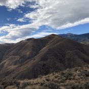
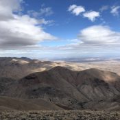
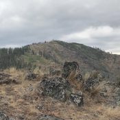
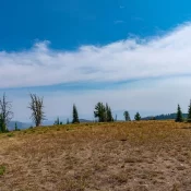
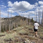
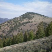
This peak is not in the book. Published November 2021 Peak 9020 is a ranked bump on the northwest ridge of Peak 10014. It towers over Kane Creek and has a steep west face. This is the first leg of a 2-peak adventure that includes Peak 9020 and Peak 10014. It covers 7.0 miles with 3,050 feet of elevation gain … Continue reading

Gerdie Hill by Jason Floyd

This peak is not in the book. Note: Jason traverses to this summit from Cavaney Hill. If you are only interested in this peak, you can use his descent route. Jason points out: “Our total stats were 6.23 miles with almost 4,000 feet of elevation gain. You could also easily add Lead Mountain to this route in a long day.” … Continue reading

Cavaney Hill by Jason Floyd

This peak is not in the book. Note: Jason traverses from this peak to Gerdie Hill. His route between the peaks continues on the Gerdie Hill page. Jason points out: “Our total stats were 6.23 miles with almost 4,000 feet of elevation gain. You could also easily add Lead Mountain to this route in a long day.” Published October 2021 … Continue reading

Stormy Point

This peak is not in the book. Published October 2021 Stormy Point is located west-northwest of Riggins on the main Seven Devil Crest. Its west face descends steeply over 5,000 feet to the Snake River. USGS Old Timer Mountain Access and Route, Class 1 Use the link below to read John Platt’s trip report for the details. … Continue reading

Peak 8180 (Jeannette Peak)

This peak is not in the book. Published October 2021 This peak is located northeast of Burgdorf Hot Springs. USGS War Eagle Mountain Access and Trail Route, Class 1+ The peak is accessed from just north of Burgdorf Hot Springs. Take Warren Wagon Road/FH-21 [(B)(2) on Page 135] from McCall. Turn off Warren Wagon Road onto [signed] French Creek Road. … Continue reading

Peak 8455

This peak is not in the book. Published August 2021 This peak is located south of Tyee Mountain. The peak offers impressive views of the Sawtooth Range. USGS Swanholm Peak Access To access the peak via FSR-312/Graham Road [(B)(2.1) on Page 153], take ID-21 from Boise for 55 miles to the turn for FSR-384 at the [signed] Edna Creek Campground … Continue reading