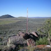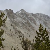
Peak 10450 is located in the Boulder Mountains between South Glassford Peak and Peak 10446. USGS Ryan Peak Access From the North Fork of the Wood River trailhead [(A)(9)(a) on Pages 241-242], follow the North Fork Big Wood River Trail to the West Pass Trail. Follow West Pass Trail north for a couple of miles before turning west on the … Continue reading
Search Results for: a cl
This named ridge point is not in the book. Published December 2019 Snowslide Point lies at the north end of a long ridge that Rick Baugher calls Snowslide Ridge. Ironically, the unranked point is officially named, but the high point (Peak 7882) is not. Since Snowslide Point is named AND is separated by almost a mile from Peak 7882, I … Continue reading
This benchmark is not in the book. Published December 2019 Shale Benchmark is the only point on Deadline Ridge with a USGS benchmark on it. It is located 1-1/2 miles south of Timber Butte and two miles north of the high point of Deadline Ridge. It is a handsome, rocky, rounded hump with beautiful views of Timber Butte, the ridgeline, … Continue reading
This peak is not in the book. Published December 2019 Flagstaff Butte is a minor hump located along Range Road where the road is heading in an east-west direction just north of the primary artillery area. This is one of the easiest peaks you will ever summit, tumbleweeds notwithstanding. USGS Christmas Mountain East Face, Class 2 Access From the signed junction … Continue reading
This point is not in the book. Published December 2019 Bellevue Benchmark is located on a west-to-east ridge between Minnie Moore Gulch and Lees Gulch. It is positioned at the very eastern tip of this ridge and overlooks the town of Bellevue. It has two USGS benchmarks on the summit, one appropriately labeled “Bellevue.” The aforementioned ridge is between Peak … Continue reading
This benchmark is not in the book. Published December 2019 Magic Benchmark is a hump that is located just west of ID-75 and about four miles south of US-20. While the shortest ascent route is via the east face from ID-75, the safer ascent route is from East Magic Reservoir Road to the north. It can also be climbed via … Continue reading