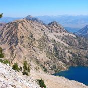
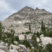
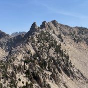
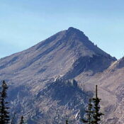
The book treated this summit and Nahneke Mountain as one peak on Page 205 with two nearly-equal summits. Due to the 464-foot drop between the two summits, the modern trend is to treat each summit separately. The easiest and most reasonable route to this summit is via a ridge traverse from Nahneke Mountain. USGS Nahneke Mountain … Continue reading
Search Results for: a cl

This peak is not in the book. This chisel-shaped summit is the least-known point on the Verita Ridge. It is located between Warbonnet Peak and Tohobit Peak. USGS Warbonnet Peak … Continue reading

This peak is not in the book. Peak 10052 is located east of the Sawtooth Crest on the long ridge that divides the Alice Lake and Toxaway Lake drainages. USGS Snowyside Peak Access Alice/Toxaway Loop [(A)(4)(a) on Page 206] Southwest Ridge, Class 2 Leave the trail at the pass between Alice and Toxawy Lakes and follow the ridge to the … Continue reading

This peak is not in the book. Derek Percoski provided the photos and route information. Updated August 2020 This occasionally climbed 10,000-foot Sawtooth peak is located due south of the west end of Toxaway Lake and NNW of Snowyside Peak. Derek Percoski reports “Over the years out of the thousands of backpackers that come to the area, each peak probably … Continue reading

This peak is not in the book. I believe it is probable that Derek accomplished the first ascent of this out of the way summit. Published October 2020 Peak 10059 is located on the main Sawtooth Crest NNW of Hidden Lake and midway between Elk Peak and Mount Cramer. The routes set out below both end with the same Class-4 … Continue reading

This peak is not in the book. Updated November 2020 Peak 10060 is located on the main Sawtooth Crest midway between Elk Peak and Mount Cramer. USGS Warbonnet Peak Access FST-101/FST-154, Redfish Lake Creek Trail [(A)(6)(b) Pages 206-207]. Take the Redfish Lake Shuttle to reach the starting point. Without the shuttle would require a high fitness level to climb the … Continue reading