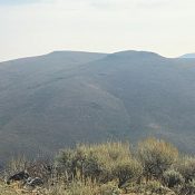
This peak is not in the book. This peak can be climbed as part of a three-peak traverse described at the following link: The Giveout Triple Play. Published November 2019 Peak 7638 sits above Whiskey Flat and is on a ridge that parallels Crow Creek Road. FSR-801 (a narrow, badly rutted jeep road only suitable for ATVs) runs the entire length … Continue reading
Search Results for: a cl
This peak is not in the book. This peak can be climbed as part of a three-peak traverse described at the following link: The Giveout Triple Play. Published November 2019 Peak 7765 is the second, and higher, ranked summit on a ridge that includes Shale Point (7,740 feet) to the south. The summit plateau/ridge crest is narrow and quite long … Continue reading
This peak is not in the book. This peak can be climbed as part of a three-peak traverse described at the following link: The Giveout Triple Play. Published November 2019 Shale Point is the first of two ranked summits on a ridgeline that is separated from the higher Snowslide Ridge to the south by Snowslide Canyon. It has Montpelier Creek to … Continue reading
This peak is not in the book. Published November 2019 Gas Benchmark is a ranked summit located in the Sheep Creek Hills south of Montpelier, Idaho. This area is mostly private land but there are access roads through it to reach BLM land (to the east and south) and National Forest land (to the north). If you stay on the … Continue reading
This peak is not in the book. Published November 2019 Peak 6684 is a brushy hill with an elongated north-to-south summit crest. The peak towers over the small hamlet of Grace, Idaho. Peak 6684 is the northernmost ranked summit in the Bear River Range. It is positioned below, and to the west of, the primary north-to-south ridge crest of the … Continue reading

This peak is not in the book. This peak is part of a multi-peak ridge traverse known as the Monument Gulch Triple Play. This traverse includes Peak 6188/Boyer Gulch Peak, Peak 6130/Middleman Peak, and Peak 6291/Monument Gulch Peak. I added a GPS track and photo. A 2-track road not shown on the USGS quadrangle leads nearly to the summit. Updated September 2020 … Continue reading