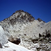
Climbing and access information for this peak is on Page 171 of the book. Some older maps show this peak as Packrat Peak. This error was corrected officially in late 2014. Alpen is a good peak to hit while traversing from Alpine Lake to the Upper Redfish Lakes Basin. USGS Warbonnet Peak … Continue reading
Search Results for: a cl
Climbing and access information for this peak is on Pages 204-205 of the book. It has been suggested and historically supported that this peak be named after Arval Anderson. Please refer to the article, Arval Anderson, Early Sawtooth Explorer and Surveyor, in the Idaho Climbing History Section of this website. USGS Mount Everly … Continue reading
Climbing and access information for this peak is on Pages 287-288 of the book. Steve Mandella added photos and a GPS track showing the two routes set out in the book. Livingston Douglas added photos which highlight the beauty of this peak. Updated November 2024 I have climbed Hawley Mountain 3 times–twice under a full moon in August. It’s a … Continue reading
Climbing and access information for Custer Peak is on Pages 131-132 of the book. Custer Peak is located 5 miles east of the Bonanza Creek Guard Station and the Yankee Fork Salmon River. The summit is identified on the Challis National Forest map as Custer Lookout. The defunct lookout is available for public use on first-come basis. Custer Peak, the … Continue reading
Climbing and access information for this peak is on Page 196 of the book. The peak is misnamed in the book as Mayan Temple. Ray Brooks explained the confusion has extended since 1972. Ray reports “ In Sept. 1972, we did make a nice first ascent of a pinnacle on the ridgeline just north of Japan Peak. We named the … Continue reading
Climbing and access information for this peak is on Pages 197-198 of the book. This peak is named after Robert and Miriam Underhill who did many first ascents in the range. USGS Warbonnet Peak … Continue reading