Peak 8722

Peak 8722 viewed from the southeast.

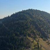
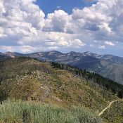
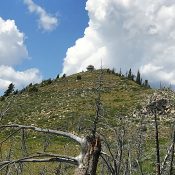
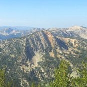
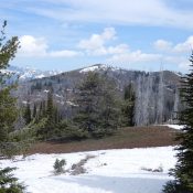
This peak is not in the book. Published August 2019 Peak 8722 is located between Pilot Peak and Elk Summit. Its slopes are composed of a red-tinted rock that is unique in this area. We ascended this peak in combination with Peak 8420. USGS Wolf Fang Peak Access Primary access for this peak is from the road that runs between … Continue reading

Peak 8498

Peak 8498.

This peak is not in the book. Published August 2019 This peak is located between Pilot Peak and Elk Summit. Although this peak is mostly covered by trees, there is a decent view from the summit. USGS Wolf Fang Peak Access Access this peak from the road that runs between Yellow Pine and Warren: FS-340 [(B)(3.2) on Page 137]. FS-341 … Continue reading

Peak 8060

Peak 8060 (just left of center) from Pilot Peak.

This peak is not in the book. Published August 2019 Peak 8060 is located roughly one mile east of Pilot Peak on the ridgeline that runs from Elk Summit to Pilot Peak. The summit was burned at some point in the recent past. USGS Pilot Peak Access Access this peak from the road that runs between Yellow Pine and Warren: … Continue reading

Pilot Peak 8057

Pilot Peak viewed from the east.

This peak is not in the book. Published August 2019 This Pilot Peak (one of two Pilot Peaks in Idaho) is located at the West Terminus of a long East/West ridgeline. The peak towers over the deep canyon of the South Fork Salmon River. As a result of its location, the peak has an active fire lookout which covers this … Continue reading

Dixie Mountain

Dixie Mountain viewed from the summit of Mount Eldridge.

Climbing and access information for this peak is on Page 120 of the book. Published August 2019 Dixie Mountain is located north of Yellow Pine, Idaho. The peak is part of an impressive ridge system that runs between Profile Gap and Elk Summit. While this ridge is not found within the Frank Church River of no Return Wilderness, it is … Continue reading

Peak 7489

Peak 7489. John Platt Photo

This peak is not in the book. Published July 2019 This peak is located southwest of Pollock Mountain. John Platt and company climbed this peak as part of a long loop hike starting south of the summit. John’s trip report is linked below. USGS Pollock Mountain Access See the Ant Butte page for the south access and the Pollock Mountain … Continue reading