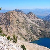
This peak is not in the book. Peak 9955 is located north of Toxaway Lake and southwest of Imogene Lake on the Sawtooth Crest. Although no one has reported climbing this peak Brett Sergenian reports that there is a man made cairn on its summit. USGS Snowyside Peak Access South Ridge [(A)(4)(a.1) on Page 206] East Ridge [(A)(5)(a) on Page … Continue reading
Book Updates
Climbing and access information for this peak is on Page 205 of the book. Flat Top Mountain is located midway between Browns Peak and Nahneke Mountain on the Queens Divide. USGS Nahneke Mountain … Continue reading
Climbing and access information for this peak is on Page 205 of the book. Browns Peak is located in the middle of the Queens River Divide. USGS Nahneke Mountain … Continue reading
The book treated this summit and Nahneke Mountain as one peak on Page 205 with two nearly-equal summits. Due to the 464-foot drop between the two summits, the modern trend is to treat each summit separately. The easiest and most reasonable route to this summit is via a ridge traverse from Nahneke Mountain. USGS Nahneke Mountain … Continue reading

This peak is not in the book. This chisel-shaped summit is the least-known point on the Verita Ridge. It is located between Warbonnet Peak and Tohobit Peak. USGS Warbonnet Peak … Continue reading

This peak is not in the book. Peak 10052 is located east of the Sawtooth Crest on the long ridge that divides the Alice Lake and Toxaway Lake drainages. USGS Snowyside Peak Access Alice/Toxaway Loop [(A)(4)(a) on Page 206] Southwest Ridge, Class 2 Leave the trail at the pass between Alice and Toxawy Lakes and follow the ridge to the … Continue reading