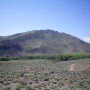
This peak is not in the book. Published November 2019 Peak 9122 sits above the mouth of Morse Creek Canyon. The easiest ascent routes are via either the mostly-open west ridge from the mouth of the canyon or the mostly-open south ridge. The upper sections of forest on these routes are relatively easy bushwhacks. Both of the aforementioned ridges are … Continue reading
Search Results for: a cl
Climbing and access information for this peak is on Page 134 of the book. Updated November 2019 Van Horn Peak is a rugged mountain with a LONG, magnificent southeast ridge. The north face of the mountain is particularly rough and has probably never been climbed. This is a rarely visited summit. Here are two new routes not discussed in the … Continue reading
This peak is not in the book. Published November 2019 Peak 9140 is a seldom-climbed, double-humped summit that is tucked behind Alder Creek Pass. It sits at the head of the Castle Creek drainage. The easiest ascent route is via FSR-341 then FST-4135 to Alder Creek Pass. Bushwhack northeast from the pass then climb a ridge north to a saddle between … Continue reading

This peak is not in the book. Updated November 2023 Peak 6216 is a hill that towers over the townsite of Ellis, ID. It is overshadowed by higher Lemhis to its east. Peak 6216 is, essentially, a ridge hump (albeit a ranked one) on the meandering west ridge of Peak 8420. This west ridge mimics the twists and turns of … Continue reading
This peak is not in the book. Published November 2019 Peak 6140 is located on the north side of McKim Creek. The only route entirely on BLM land is via McKim Creek Road and the east face. The east face is easily accessed from McKim Creek Road just below a saddle at the base of the face. The southwest ridge … Continue reading
This peak is not in the book. Published November 2019 Peak 5941 is [barely] a ranked summit that is positioned at the west end of the long west ridge of Sal Mountain. It is located just below, and to the northwest of, Ten Mile Benchmark, an unranked ridge bump. Peak 5941 offers a beautiful aerial view of the twisting Salmon … Continue reading