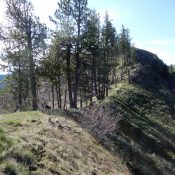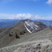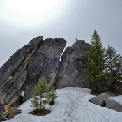
This peak is not in the book. Published May 2020 Keyhole Mountain is unofficially named after the keyhole in the peak’s summit block. Although one of the lower elevation summits on the Log Mountain -Deadwood Divide, it is a long haul to reach its summit from the deep South Fork Salmon River Canyon bottom. USGS Teapot Mountain Access This peak … Continue reading
Search Results for: a cl
The Red Hills are the middle group of three large ridges that buttress the Lost River Range’s eastern flank. The Donkey Hills are the northernmost group and the Hawley Mountains are the southern group. This northwest-to-southeast ridge is bounded by Dry Creek on its north and east sides, Wet Creek on its south side, and Corral Creek to the west. … Continue reading
The eastern slopes of the Lost River Range are buttressed by three ridges that parallel the main crest. From north to south, these three groupings are the Donkey Hills, the Red Hills, and the Hawley Mountains. The Donkey Hills are the largest of these three groups. The Donkey Hills trend from northwest to southeast and include seven ranked summits. There … Continue reading
This peak is not in the book. Published May 2020 This peak is located northwest of New Meadows at the far south end of the Seven Devil Mountains. Mud Creek is on its east side and the Weiser River is on its west side. USGS Railroad Saddle Access Drive west from New Meadows on US-95 for 5.3 miles. Turn right … Continue reading
This peak is not in the book. Published May 2020 This peak sits directly north of Pittsburgh Saddle. Its slopes offer great views of Hells Canyon. USGS Grave Point Access Primary access is via FS-493/Pittsburgh Landing Road [(A)(2) on Page 104]. Park at the saddle to climb the peak’s south ridge. South Ridge, Class 2 The south ridge is a … Continue reading
This peak is not in the book. Published May 2020 This peak is located north of Pittsburgh Saddle in the northern Seven Devils. The summit sits due west of the range’s crest and south of Camp Howard Ridge. USGS Grave Point Access Primary access is via FS-493/Pittsburgh Landing Road [(A)(2) on Page 104]. Turn onto FS-493F roughly 0.5 miles below … Continue reading