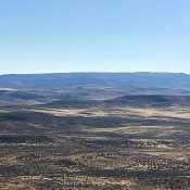
This peak is not in the book. Published November 2018 East Hill sits directly above Georgetown and offers a birds-eye view of the town. The summit has a repeater antenna (+ solar panel) and another antenna; both antennas are at the southwest edge of the tilted summit plateau. That point is where the 7,297-foot elevation was measured (according to the … Continue reading
Search Results for: a cl
This peak is not in the book. Published November 2018 Peak 7885 lies in between Dunns Canyon and the Right Hand Fork of Georgetown Canyon. It overlooks White Pass to its east. Please note that the trail over White Pass (connecting Dunns Canyon to the RHF of Georgetown Canyon) no longer exists. The USGS topo map mistakenly shows it. An ascent … Continue reading
This peak is not in the book. Published November 2018 Peak 9420 sits at the head of Rowley Canyon and is located just over a mile southeast of Threemile Peak. It is the highest and northernmost of a series of scrub-covered humps on the east side of the Bear River Valley between Georgetown and Bennington. Bald Mountain (9,248 feet) is … Continue reading
This peak is not in the book. Published November 2018 Threemile Peak is an impressive mountain that rises up from the farmland and ranchland of the Bear River Valley. It is located east of US-30 between Georgetown and Bennington. USGS Georgetown Northwest Spur/North Ridge, Class 2 Access From the signed turnoff on US-30 in the center of the bustling metropolis of … Continue reading
This peak is not in the book. Published November 2018 Peak 7551 is a satellite summit of the long west ridge of Meade Peak. It is a gentle hump of broken rock and desert scrub. It provides an outstanding view of the aforementioned ridge, just the ticket if you are doing recon on Meade Peak, which I was. I would … Continue reading

This peak is not in the book. Published November 2018 Swisher Mountain is comprised of a massive 6-mile long ridgeline that is located northeast of Jordan Valley, Oregon, and just east of the Idaho/Oregon border. There is an abandoned repeater station and USGS benchmark on the western edge of the peak’s large, rounded summit. The highest point is east of … Continue reading