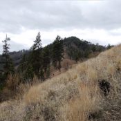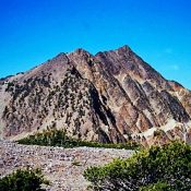
This peak is not in the book. Updated December 2018 Left Wright Peak is a spectacular peak located on the main Lemhi Range Crest at the headwaters of four drainages: North Fork Morgan Creek, Cow Creek, Wright Creek and Kadletz Creeks. The peak would be unknown were it not for the explorations of Rick Baugher. USGS May Mountain Access Kadletz … Continue reading
Search Results for: a cl
This peak is not in the book. Published December 2018 North Morgan Peak is located north of May, above the North Fork Morgan Creek. This drainage is surrounded by 10 ranked peaks. Only 2 of the 10 have official names (Red Point and Long Mountain). USGS May Mountain Access North Fork Morgan Creek FST-071 [(C)(1)(a) on Pages 316-317] West Ridge, … Continue reading
This peak is not in the book. Additional Danskin Mountains access information is in the book [(D)(1) on Pages 154-155 and (G)(1) on Page 156]. Also see the following website page: Danskin Mountains OHV Trails. Published December 2018 Peak 4940 is located west of Long Tom Reservoir on the western fringes of the Danskin Mountains. The actual summit is on … Continue reading
This peak is not in the book. This page is based on information from John Platt. His trip report is linked below. Published November 2018 Peak 5998 is located west of the confluence of the East Fork South Fork Salmon River and the South Fork Salmon River. The rocky point directly above the confluence is named Indian Point. Consequently, John … Continue reading
This peak is not in the book. Published November 2018 Peak 8974 sits at the head of the Middle Fork Bloomington Creek drainage. Unlike its rocky brethren to the east (Peak 8963 and Peak 8852), this peak is a gentle giant. It has a magnificent south ridge. You are likely to find cattle grazing on its lower slopes. USGS Paris … Continue reading
This peak is not in the book. The name is derived from a City of Rocks National Reserve sign. Published November 2018 Greene Mountain is the easternmost summit within the boundaries of the City of Rocks National Reserve. It is a rocky, thickly forested peak that sees few visitors. The only reasonable way to climb the peak on public land is … Continue reading