Climbing and access information for this peak is on Page 129 of the book. Published August 2019 Langer Peak is located northeast of Roughneck Peak and northeast of Langer Lake. USGS Langer Peak … Continue reading
Climbing and access information for this peak is on Page 129 of the book. Published August 2019 Langer Peak is located northeast of Roughneck Peak and northeast of Langer Lake. USGS Langer Peak … Continue reading
This group of peaks is located east of the Log Mountain/Deadwood Divide. This group is bounded by Johnson Creek and the Deadwood River in the west and ID-21 and the Middle Fork Salmon River in the east. In the north, the divide begins at Murphy Peak on Red Ridge (see Big Creek to Red Ridge Peaks below) near Monumental Summit … Continue reading
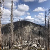
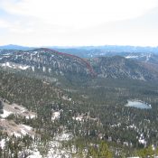
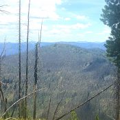
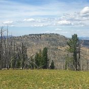
This peak is not in the book. Published August 2019 Peak 8420 is located just north of Whitehawk Mountain. It is the highest point on the ridge that divides the Deadwood River drainage from the Bear Valley Creek drainage. This peak is a victim of the Pioneer Fire which burned much of the surrounding area. The summit is formed by a … Continue reading
This peak is not in the book. Published August 2019 Peak 8658 is located along Artillery Dome Road between Peak 8681 and Walkers Peak. Its big, rounded summit is an excellent viewpoint for surveying the Frank Church River of No Return Wilderness. USGS Big Soldier Mountain Access To reach this peak, use the Warm Lake/Landmark/Stanley Road (FS-22/579), which runs across … Continue reading
This peak is not in the book. Published August 2019 This peak is southeast of Little Baldy and is located along the Artillery Dome Road. USGS Pistol Lake Access To access this peak, use the Warm Lake/Landmark/Stanley Road (FS-22/579), which runs across the Salmon River Mountains between ID-55 and ID-21, to reach Landmark, Idaho [(C)(1) on Page 138]. The town … Continue reading
This peak is not in the book. Published August 2019 Little Baldy is located on the western boundary of the Frank Church River of No Return Wilderness, northeast of Landmark and south of Lake Mountain. The peak’s nearly 1-mile long summit ridge encompasses a beautiful rolling meadow. The northernmost high point is the true summit, outdoing the southern summit area … Continue reading