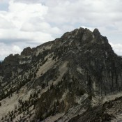
Climbing and access information for this peak is on Pages 129-130 of the book. This peak anchors the north end of the Tango Peaks. It has the Knapp triangulation station benchmark on its summit and has also gone by the name Knapp Benchmark as a result. A Class 3 route leads to the top but it is a long way … Continue reading
Search Results for: a cl
Climbing and access information for this peak is on Page 210 of the book. Livingston Douglas contributed the updated route description set out below. Updated December 2021 Titus Peak is smaller than its neighbors Bromaghin Peak and Saviers Peak and is often climbed as part of a ridge run from Galena Summit to Saviers Peak. USGS Galena Titus Peak by … Continue reading
Climbing and access information for this peak is on Page 151 of the book. The highest point in the Boise Mountains is a formidable peak from many directions, but is only a Class 2 scramble from the south. Its North Summit is a bit more challenging and the traverse between the two summits can be tricky. USGS Newman Peak … Continue reading
Climbing and access information for this peak is on Pages 211-212 of the book. Updated November 2022 Prairie Creek Peak sits just south of Prairie Lakes on the main Smoky Mountain Crest. It is roughly 1.4 miles southwest of Norton Peak. USGS Baker Peak Access This is the second leg of a 2-peak adventure that includes Norton Peak (10,336 feet) … Continue reading
Climbing and access information for this peak is on Page 262 of the book. Mackay Peak is the impressive mountain serving as a backdrop to Mackay, Idaho. It is an easy peak to reach, thanks to the mining roads that lead high up its slopes. Miners or Native Americans probably made the first ascent of the peak. USGS Mackay Reservoir … Continue reading
Climbing and access information for this peak is found on Pages 335-336 of the book. Livingston Douglas pointed out a few errors in the book, noting: —The elevation of the peak is 10,300 feet (the book has it at 10,280 feet); —The peak is on the USGS Targhee Peak quadrangle rather than the Targhee Creek quadrangle; —The west ridge is … Continue reading