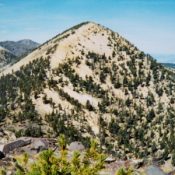
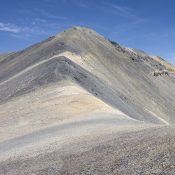
Peak 10153 by Livingston Douglas

Climbing and access information for this peak is on Page 323 of the book, where the peak is incorrectly identified as Elk Mountain. The actual Beaverhead Elk Mountain is located just over a mile south of Peak 10153. USGS Deadman Pass. Published April 2018 Access Hall Creek Road [(B)(5.1)(a) on Page 329] as revised and updated. Please refer to the … Continue reading

Point 7860 Twin Falls County HP

The Twin Falls County High Point. Dan Robbins Photo

This point is not in the book. Dan Robbins, Ken Jones and Livingston Douglas provided the beta and photos for this page. Updated November 2020  Point 7860 is the Twin Falls County High Point. It is part of a ridge that spills from Nevada’s Jarbidge Mountains across the border into Idaho. Since it is accessed from the Snake River Plain … Continue reading

Peak 6180 (Benewah County HP)

Peak 6180, the Benewah County High Point. Dan Robbins Photo

This peak is not in the book. Peak 6180 is the highest point in Benewah County. It is located south of Latour Peak. USGS Twin Crags Contributor Ken Jones provided the following route information: From I-90 west of Pinehurst, take the exit on the east bank of the Coeur d’Alene River and head south on Latour Creek Road. The  pavement … Continue reading

Gem County High Point

Peak 7971. Dan Robbins Photo

This peak is not in the book. Updated September 2018 This peak is the highest point in Gem County. It is located in the northeast corner of the county and five miles north of Snowbank Mountain. Two routes are set out below. A third possibility is to hike the peak from the north via the road system north of the … Continue reading

Blue Ridge (Blackfoot Benchmark)

This peak is not in the book. Published April 2018 The highest point in Bingham County does not have a name specifically attached to it. The USGS benchmark on its summit is named “Blackfoot” it is the high point on Blue Ridge. The summit is located on State of Idaho land but is surrounded by private land which makes accessing the … Continue reading

Peak 7194

Peak 7194 from Peak 6990. Steve Mandella photo.

This peak is not in the book. Livingston Douglas provided new route information which is set out below Margo’s entry. Updated December 2019 Southeast and Northeast Ridges by Margo Mandella Peak 7194 is in the Jumpoff Peak subrange of the Lost River Range. Located west of the Idaho National Laboratory and ID-22, Peak 7194 and its peak neighbors (Peak 8383 … Continue reading