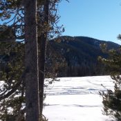
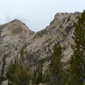
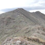
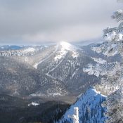
Peak 9860

Mattingly Peak is the summit on the right. John Platt Photo

This peak is not in the book. Peak 9860 is located next to Mattingly Peak and west of Alturas Lake. Climb the peak from the Mattingly Peak/Peak 9860 saddle. See the Mattingly Peak page for directions. USGS Snowyside Peak … Continue reading

Peak 10439

This peak is not in the book. This peak is located east of the Lost River Range Crest and due east of Jaggle Benchmark and Peak 10571. Use the directions for Jaggle Benchmark and Peak 10571 in the book to access this peak (Pages 288-289). USGS Sunset Peak … Continue reading

Peak 10692 Revised by Livingston Douglas

This peak is not in the book. Livingston Douglas revised this page with a new route and new photos. Elevation and prominence figures reflect recent LiDAR updates. Historically, a number of climbers have scrambled over this peak on their way to North Twin. Ken Jones used FS-214 to approach the peak from the north. FS-214 is not in the book … Continue reading

Peak 10199 (Sawmill Hill)

This peak is not in the book. The map elevation is 10,195 feet. LiDAR calculations place the elevation at 10,199 feet. The unofficial name was proposed by Rick Baugher. Derek Percoski climbed this peak in 2018 as part of loop that also included White Cap Peak. Livingston Douglas climbed the west face and descended the north ridge in 2024. Both … Continue reading