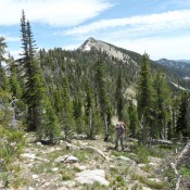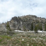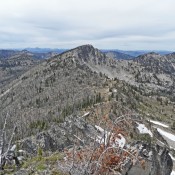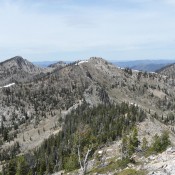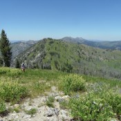
This peak is not in the book. I recommend climbing Serene Peak from Hard Peak by following the connecting ridgeline north. The ridgeline is mostly open with good footing. The walk between the two peaks is less than a mile. You will gain and lose slightly more than 300 feet in the process. You can also traverse across the North … Continue reading
Search Results for: a cl
This peak is not in the book. Peak 10102 is located northwest of Peak 10356. The peak can be approached from the north via the North Fork Big Lost River Road and then either Squib or Miller creeks. It can also be approached from the south via Trail Creek. The Trail Creek approach is undoubtedly the most efficient. You can … Continue reading
Climbing and access information for this peak is on Page 121 of the book. Please note that the book spells the peak name as “Wilson Peak” whereas the USGS topo map labels it as “Willson Peak.” In 2018, John Platt led a group across the ridge. Read his trip report at this link: Profile Loop 2018. The next peak along … Continue reading
Climbing and access information for this peak is on Page 120 of the book. In 2018, John Platt led a group across the ridge. Read his trip report at this link: Profile Loop 2018. Updated June 2018 Crater Peak is located just east of Profile Gap. It is the first of 7 peaks between Profile Gap and Parks Peak to … Continue reading
Climbing and access information for this peak is on Pages 120-121. In 2018, John Platt led a group across the ridge. Read his trip report at this link: Profile Loop 2018. The next peak along the ridge is Peak 8615. Updated June 2018 Profile Peak is located at the top of the Big Creek Drainage. It is part of a … Continue reading
Climbing and access information for this peak is on Page 120 of the book. In 2018, John Platt led a group across the ridge. Read his trip report at this link: Profile Loop 2018. The next peak along the ridge is Big Creek Point. Updated June 2018 Big Creek Point is located between Willson Peak and Peak 8615 on the … Continue reading