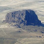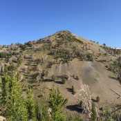
Peak 8082

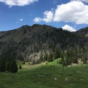
Peak 8082 viewed from near Beaverland Pass.

This peak is not in the book. Margo Mandella and Livingston Douglas provided the alternative and harder routes found down the page. Updated November 2019 Peak 8082 is located a mile south of Peak 8150 on the ridge that parallels US-93 from Arco to Moore. You can climb Peak 8082 from almost any direction but the easiest route follows the … Continue reading

Peak 8150

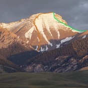
Peak 8150 viewed from near Beaverland Pass.

This peak is not in the book. Livingston Douglas provided the alternative access and new route information found below. Updated November 2019.  Peak 8150 is located east of Moore, Idaho, on the north end of a moderate ridge that runs south from its summit to Arco Peak and ends just east of Arco, Idaho. The ridge parallels US-93. USGS Arco … Continue reading

Caribou Mountain

Caribou Mountain viewed from the Grays Lake Road to the west.

Climbing and access information for this peak is on Page 371 of the book. Below you will find updated and more detailed access and route information from my climb of the Northwest Cirque Traverse, Livingston Douglas’ climb of the south ridge and Ken Jones’ trip report 2011. Updated November 2020 Caribou Mountain is one of the most desirable peaks found … Continue reading

Peak 10149 (East Burnt Peak)

This peak is not in the book. East Burnt Peak sits east of the head of the East Fork of Burnt Creek. See map below, which shows this intermittent stream as East Fork Burnt Creek. This peak is connected to Apex Peak via a saddle at 9,360 feet. This grass- and talus-covered peak can be approached from almost any direction. … Continue reading

Peak 10470 (Little Mill Mountain)

Little Mill (Mill Mtn. is on the left). The SW Ridge ascends from the saddle NW of Mill Lake. Judi Steciak Photo

This peak is not in the book. Updated September 2020 Little Mill Mountain is located just southeast of Mill Mountain. The two peaks are connected by a Class 2 ridge. It is a Class 2 scramble from the connecting saddle to the summit. USGS Mogg Mountain Access Drive to Mill Lake via Mill Creek Road FS-010 and FS 006 [(A)(9.2) … Continue reading

Sinker Butte

This peak is not in the book. There are two routes set out below. Updated November 2022 Sinker Butte is located south of the Snake River by Idaho Power’s Swan Falls Dam. While not a sharp, dominating summit, the peak is an excellent vantage point from which to view the impressive Snake River Canyon. Two routes are included below. The … Continue reading