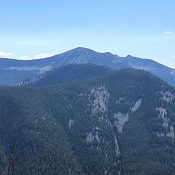
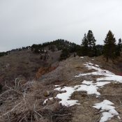
Johnson Benchmark by Livingston Douglas

This peak is not in the book. See the link below for Dan Robbins’ trip report for details of a winter ascent. Updated November 2019 Johnson Benchmark sits south of the town of Fairfield, Idaho and west of ID-46. Johnson Benchmark lies in the Bennett Mountain Hills which is managed by the Bureau of Land Management. USGS Spring Creek Reservoir … Continue reading

The Knob

This peak is not in the book. The Knob is located southwest of the town of Fairfield, Idaho, and north of the Camas County/Gooding County line. With 874 feet of prominence, The Knob is a dominant peak in the middle section of the Bennett Mountain Hills, which is managed by the Bureau of Land Management. See the link to Dan Robbin’s … Continue reading

Bennett Mountain

Bennett and South Mountain. The south peak is on the right.

This peak is not in the book. Updated December 2019 Scenic Bennett Mountain, with 1,981 feet of prominence, is the highest point in the Bennett Mountain Hills. There are actually two summits. The south summit (South Bennett Mountain) is 120 feet lower in elevation (7,321 feet). Private property blocks access to the north summit. USGS Bennett Mountain Roughly one-half of … Continue reading

South Bennett Mountain

Bennett and South Mountain. The south peak is on the right.

This peak is not in the book. Updated May 2018 South Bennett Mountain is located southwest of Bennett Mountain on land managed by the Bureau of Land Management. It is 120 feet lower than the North Summit. Posted privately owned land that is not accessible to the public lies between the two peaks. USGS Bennett Mountain Access South Bennett Mountain … Continue reading

Wood Creek Mountain

This peak is not in the book. Revised May 2018  Wood Creek Mountain is located within the Boise National Forest, east of Little Camas Reservoir and north of Peak 5888. The mountain is located on a in-holding of Forest Service-managed public land, surrounded largely by private land and bordered by a State-managed parcel to its northeast. Dan Robbins reports that … Continue reading

Packer Butte

Packer Butte from the north along the Castle Rock Road

This peak is not in the book. The summit is located on State of Idaho Land which should be open to the public. However, the status of this particular State of Idaho land is not clear. The State of Idaho often leases its land to private entities under terms that prohibit public access. In this case, there are no fences … Continue reading