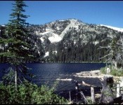
This peak is not in the book. Joe Peak is located just west of Hidden Lake which sits between it and Red Top. This is rugged, scenic country with lots of exposed granite. Hidden Lake is reached by trail. See [(D)(1)] on Page 48 of the book. The Forest Service describes the route to the lake as follows: The trail … Continue reading
Search Results for: a cl

This peak is not in the book. Red Top is reached by a trail. You will find remnants of a fire lookout on top. USGS Shorty Peak The Forest Service describes the route as follows: The trail switchbacks through an old burn for the first 0.4 mile at about a 15% grade. It enters the woods at this point and … Continue reading
This peak is not in the book. Peak 6357 sits south of Trestle Peak and just west of the Alpine Trail. It is roughly a 400-foot climb to the summit from the trail. You will find great views of Lake Pend Oreille from the summit. The Forest Service maintains a web page for this trail named the Bee Top/Round Top … Continue reading

Climbing and access information for this peak is on Page 57 of the book. Latour Peak is the highest peak in the Saint Joe Mountains and is the Kootenai County high point. That status combined with its 2,028 feet of prominence make Latour Peak a popular destination. USGS Twin Crags Ken Jones provided the following directions to the summit: From … Continue reading

This peak, the highest summit in the Webster Range, is not in the book. Rick Baugher provided the first update found below. Livingston Douglas supplied the second update. USGS Stewart Flat. Updated November 2018 Draney Peak Update by Rick Baugher The Webster Range, the eastern extending finger of the Peale Mountains, is the headwaters source of the Blackfoot River. It … Continue reading

This peak is not in the book. Rick Baugher provides the following report on the steepest peak in Oneida County. USGS Malad Summit “New Point” (6,940 feet) has been identified as the steepest of the 93 peaks in Oneida County, Idaho. Its broken-cliff Southwest Face is easily seen from nearby I-15. Even so, it flew under my radar for 30 … Continue reading