White Top Mountain

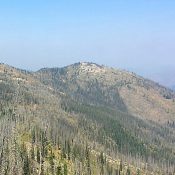
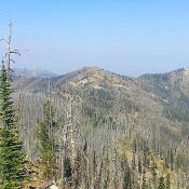
White Top Mountain from Burnt Knob.

Climbing and access information for this peak is on Page 83 of the book. White Top Mountain sits northeast of Burnt Peak and due east of Peak 7933/White Top Mountain West. Use Peak 7933’s page to learn about access. Climb the peak from its higher, western neighbor via the connecting ridge. Class 2. USGS Sabe Mountain   … Continue reading
Peak 7933 (White Top Mountain West)

This peak is not in the book. Peak 7933 sits northeast of Burnt Knob. The peak is arguably the high point of White Top Mountain. The official name was placed on the lower summit which sits to the east. USGS Sabe Mountain The summit can be reached by FST-539 (Forest Service Map)/FS-502 (trailhead sign), which begins on the north side … Continue reading

Burnt Knob

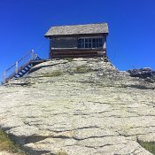
The scenic fire lookout is in poor condition.

This peak is not in the book. Burnt Knob is one of the most spectacular summits in the southern Clearwater Mountains. Its granite summit towers over a steep Northeast Face which drops 800 feet precipitously down to the Burnt Knob Lakes. An old fire lookout sits on the summit. The scenic, massive view from the summit is tempered by the … Continue reading

Green Mountain

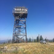
Green Mountain and its tall, nearly abandoned lookout.

Climbing and access information for this peak is on Page 73 of the book. Green Mountain is a broad summit with an imposing wooden fire lookout tower on its summit. You can drive to the summit with a high-clearance vehicle. Leave the Magruder Corridor Road 19.9 miles from its western terminus and turn onto the Elk Mountain Road/FS-285. This road … Continue reading

Peak 7390

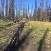
The summit of Peak 7390 is not remarkable. However, if you walk to the southern slopes there is a good view across the Frank Church River of No Return Wilderness.

This peak is not in the book. Peak 7390 serves as a gateway to the northwestern corner of the Frank Church River of No Return Wilderness. FST-501 leaves the Magruder Corridor Road/FS-468 at the 14-Mile Tree trailhead, which is 14.4 miles east of the west end of FS-468. The trail leads over the summit in 0.9 miles with 400 feet … Continue reading

Crittenden Peak

Climbing and access information for this peak is on Page 84 of the book. Crittenden Peak sits on the Idaho/Montana border on a section of the ridge crest south of Dominion Peak. The peak has a steep Northeast Face dropping into Montana but its Idaho side is nondescript at best. Its tree-covered summit is easily accessed from the State Line … Continue reading