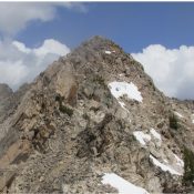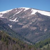
This peak is not in the book. Annies Peak is located east of the townsite of Patterson, Idaho. Rick Baugher climbed this peak. A Forest Service trail crosses its North Slopes. I recommend climbing the peak from that trail. Access the trail from Patterson by driving up Patterson Creek. The road ends at the point where the East Fork Patterson … Continue reading
Search Results for: a cl
Climbing and access information for this peak is on Page 131 of the book. Peak 10006 is overshadowed by nearby Mount Jordan and The General. USGS Mount Jordan … Continue reading
This peak is not in the book. Peak 10100 is located just southwest of Bald Mountain. Although I know several friends who climbed Bald Mountain, none of them ventured over to this peak which rises 400 feet from the connecting saddle. If I were going to climb this peak, I would do it in combination with an ascent of Bald … Continue reading
This peak is not in the book. No one has reported climbing this peak which sits above Challis Creek Lakes and south of White Mountain. I’ve not visited Challis Creek Lakes but a road leads to them and climbing the peak by its West Ridge which rises up above the lakes looks straightforward on the topo map. Please let me know … Continue reading
Climbing and access information for this peak which encompasses the Goat, Eagle and Chipmunk Perches is on Page 180 of the book. This peak sits just west of Elephants Perch. The more famous formations (the Goat, Eagle and Chipmunk Perches) are located on its North Slopes. USGS Mount Cramer … Continue reading
This peak is not in the book. Derek Percoski added additional commentary to this page and a photo. The route description below is on based Brett Sergenian‘s trip report which is linked below. Updated November 2022 Peak 10375, locally known as Liberty Peak, sits on the Grand Mogul Divide directly south of Decker Peak. Derek Percoski point out that “Despite the map … Continue reading