Red Top

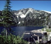
This peak is not in the book. Red Top is reached by a trail. You will find remnants of a fire lookout on top. USGS Shorty Peak The Forest Service describes the route as follows: The trail switchbacks through an old burn for the first 0.4 mile at about a 15% grade. It enters the woods at this point and … Continue reading

Peak 6357

This peak is not in the book. Peak 6357 sits south of Trestle Peak and just west of the Alpine Trail. It is roughly a 400-foot climb to the summit from the trail. You will find great views of Lake Pend Oreille from the summit. The Forest Service maintains a web page for this trail named the Bee Top/Round Top … Continue reading

Latour Peak

Climbing and access information for this peak is on Page 57 of the book. Latour Peak is the highest peak in the Saint Joe Mountains and is the Kootenai County high point. That status combined with its 2,028 feet of prominence make Latour Peak a popular destination. USGS Twin Crags Ken Jones provided the following directions to the summit: From … Continue reading

Draney Peak

East aspect of Draney Peak. In foreground is Tygee Ridge on the Idaho-Wyoming line. Rick Baugher Photo 1/20/14

This peak, the highest summit in the Webster Range, is not in the book. Rick Baugher provided the first update found below. Livingston Douglas supplied the second update. USGS Stewart Flat. Updated November 2018 Draney Peak Update by Rick Baugher The Webster Range, the eastern extending finger of the Peale Mountains, is the headwaters source of the Blackfoot River. It … Continue reading

Temple Peak

This peak is not in the book. With a prominence of 639 feet, Temple Peak was calculated as the steepest of the 19 peaks in Teton County, Idaho by Tim Worth. Rick Baugher has climbed this peak. Rick’s trip report follows. This mountain is one of several located in the core area of the Big Hole Mountains. A quick glance … Continue reading

Wedge Butte

Livingston Douglas provided the updated route information and additional photos found below. Livingston descended the west face. I recently climbed his route of descent and added a description and map of that route. Updated November 2021 Wedge Butte is an impressive volcanic remnant located on the north edge of the Snake River Plain just east of ID-75. It is a … Continue reading