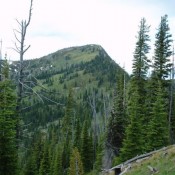
Climbing and access information for this peak is on Page 85 of the book. This peak is the highest point in Shoshone County. See Dan Robbins’ trip report which covers this peak and several other Northern Idaho county high points. USGS Illinois Peak It is 5.0 miles from Freezeout Pass to the top of the peak with 1,500 feet of … Continue reading
Search Results for: a cl
Climbing and access information for this peak is on Page 131 of the book. Red Mountain is located 2.0 miles east of Cabin Creek Peak. It is part of the Tango Peak Subrange of the Salmon River Mountains. USGS Mount Jordan … Continue reading
The Tango Peaks are on a North-South Ridge found in the southeast corner of the Eastern Salmon River Mountains NNE of Stanley, Idaho. The Tango Peaks include Mount Loening, Last Tango Peak, Cabin Creek Peak and Red Mountain. Additionally, there is an unnamed peak comprised of 3 dark rock towers that I call the The Black Tower that, as far … Continue reading
This peak is not in the book. It is located 1.9 miles west of Blacknose Peak. Johnson Creek is on its south side. Pinchot Creek is on its east side and Ballentyne Creek is on its north side. It connects via a ridge to Smoky Peak. I have not climbed it or talked with any one who has. The region … Continue reading
Climbing and access information for this peak is on Pages 181-182 of the book. There are 3 reported routes on the peak ranging from Class 4 to Class 5.6. USGS Mount Cramer … Continue reading
This peak is not in the book. Judi recommends the name “Peace Sign Peak.” Rick Baugher suggest the name “Jaywalk Peak.” Updated October 2023 Peak 9758 is located 2.2 miles north of Estes Mountain. I have not climbed this peak or met anyone who has climbed it. It can be climbed from Loon Creek Summit or from the vicinity of … Continue reading