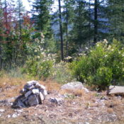
This peak is not in the book. Published November 2023 Linfor Hill is a forested peak that towers over 2,000 feet above the hamlet of Linfor to its west. CR-9 and the Coeur d’Alene River run along the west and northwest base of Linfor Hill. It is most easily climbed via FST-1319 and its east ridge. USGS Kellogg West … Continue reading
Search Results for: a cl
This peak is not in the book. Published November 2023 Thomas Hill is a ridgeline hill with four distinct summit humps. It is located west of Graham Mountain in the Coeur d’Alene Mountains north of I-90. The high point of Thomas Hill is NOT the official/measured southeast summit but is the northwest summit. The northwest summit has the wreckage of … Continue reading
This peak is not in the book. Published November 2023 Best Hill is a forested hill that is located on the northeast side of Coeur d’Alene. It sits above Cherry Hill Park. This area is a mix of private and public (City of Coeur d’Alene) land, so be careful. This route is on City of Coeur d’Alene land but skirts … Continue reading
This peak is not in the book. Published November 2023 Killarney Mountain is a forested peak that is located southwest of Fourth of July Summit in the Coeur d’Alene Mountains. It sits at the head of the Mill Creek drainage. Killarney Mountain is easily accessible thanks to a service road to the communication towers near its summit. USGS Lane Access … Continue reading
This peak is not in the book. Published November 2023 Tubbs Hill is located on the south side of Coeur d’Alene and is almost completely surrounded by massive Coeur d’Alene Lake. This area is a mix of private and public (City of Coeur d’Alene) land, so be careful. A trail system gets you to the summit. USGS Coeur d’Alene Access … Continue reading
This peak is not in the book. The peakbagger.com website identifies this peak as the Carlin Divide North. Published November 2023 Peak 3510 is a double-humped peak that is located south of Carlin Creek on the east side of Coeur d’Alene Lake. It is most easily climbed via its southeast ridge from FSR-808. This area is a mix of private … Continue reading