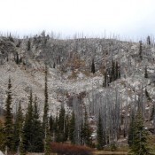
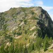
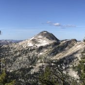
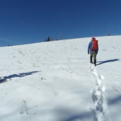
North Promontory Range

The name North Promontory Range is sometimes used to identify the southern end of the Malad Range. The name is found on the BLM’s Malad City land status map but not the USGS quadrangles. This range is discussed in the book on pages 357 and 358. Since the name appears to have been abandoned this area will be covered as … Continue reading

SAMARIA MOUNTAINS

Peak 7695 viewed from Samaria Mountain.

The Samaria Mountains are briefly covered in the book on Page 357. Updated June 2020 This small, attractive mountain range is located on the Idaho/Utah border just west of 1-15. The range’s high point is on Samaria Mountain (7,795 feet). Peak 7695 is another high range vantage point worth visiting because of its expansive views. The first Mormon settlers in … Continue reading

Ninety Percent Range

The Ninety Percent Range is the southernmost extension of the Blackfoot Mountains. It extends southeast from the Chesterfield Range to Soda Springs. The smallest named mountain range in Idaho (roughly 7 miles long and 3 miles wide), it is a mountain range in name only. It is, in reality, a ridge attached to the Soda Springs Hills. The highest point … Continue reading

Chesterfield Range

The Chesterfield Range, an extension of the Blackfoot Mountains, is located between the Blackfoot River basin to the northeast and the upper Portneuf River Valley to the southeast. To the south, the Chesterfield Range is separated from the Soda Springs Hills by Tenmile Pass. This minor escarpment is roughly 30 miles in length and is composed of a series of … Continue reading

Webster Range

East aspect of Draney Peak. In foreground is Tygee Ridge on the Idaho-Wyoming line. Rick Baugher Photo 1/20/14

This Peale Mountain subrange forms the eastern boundary of these mountains. The range is located along the Idaho/Wyoming border, stretching 25 miles from north to south. Draney Peak at 9,131 feet is the highest point in this group. This range is discussed on Page 368 of the book. Use this link to find all Webster Range summits covered on this … Continue reading

Grays Range

This Peale Mountain subrange forms the northernmost extension of the range. This group rises up south of Grays Lake and extends southeast for roughly 10 miles.  The range’s highest point is Henry Peak (8,319 feet elevation; 1,579 feet of prominence), but was originally known as “Lanes Butte,” in honor of HK Lane, a circa 1858 emigrant who is buried along Lander … Continue reading