PORTNEUF RANGE

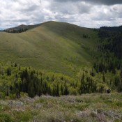
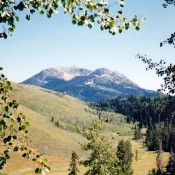
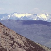
The Portneuf Range, which begins east of Blackfoot and extends southeast for 60 miles, is broken by the Portneuf River, which cuts through it at Lava Hot Springs. The northern section of the range begins along the Blackfoot River and gradually climbs up to the summits of North and South Putnam Mountains. Moving south, the crest undulates, reaching its highest … Continue reading

SOUTH HILLS A.K.A GOOSE CREEK MOUNTAINS

This group of mountains is briefly covered in the book on Page 347. Old maps identified these mountains as both the Goose Creek Mountains and the Cassia Mountains. These two names have disappeared from use and this area is now simply known as the South Hills. Recognizing both local usage and the absence of the old names from newer maps, … Continue reading

DEEP CREEK MOUNTAINS

The Deep Creek Mountains are discussed on Pages 353-355 of the book. The Deep Creek Mountains form a rugged, linear and unbroken escarpment that begins near American Falls and runs south for 30 miles toward Holbrook. The Arbon Valley flanks the range on the east; the Rockland Valley on the west. Deep Creek Peak is the highest point in the … Continue reading

CARIBOU RANGE

The Caribou Range encompasses an area more than 60 miles in length and 20 miles in width and reaches 9,805 feet on Caribou Mountain. The northern end of the range is composed of parallel ridges that rise and fall in wavelike succession, while the central portion of the range contains all of the major summits. The Caribou landscape is interspersed … Continue reading

BLACK PINE MOUNTAINS

The Black Pine Mountains are discussed on Pages 351-353 of the book. Updated May 2020 The Black Pine Mountains are located just north of the Utah border and west of I-84. Geographically, the range is the most distinctly defined mountain range in Idaho. It is surrounded by wide, flat valleys, and rises steeply on all sides. Geologically, the range is … Continue reading

WHITE KNOB MOUNTAINS

ACCESS UPDATES: Click For Updates The White Knob Mountains are a compact group of sedimentary peaks located west of Mackay. The range’s west to east trending crest is about 30 miles in length and 10 miles in width. The East Fork Big Lost River and the Big Lost River almost completely encircle the White Knob Mountains, forming the range’s southern, … Continue reading