Kelly Mountain

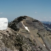
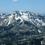
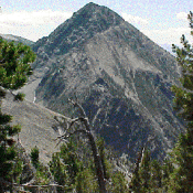
This peak is not in the book, although I skied to its summit several times in the late 1970s and early 1980s. Given the popularity of Kelly Mountain, this page contains route descriptions by Rick Baugher, and Livingston Douglas. The Jefferson County HP is located on the slopes of this mountain. Updated November 2019 Kelly Mountain is a broad hump-shaped peak … Continue reading

Mount Baird

Climbing and access information for this peak is on Page 339 of the book.  Mount Baird, the Bonneville County High Point and the highest peak in the Snake River Range, is a gorgeous mountain with expansive views. This page augments the information found in the book, which focuses on the north ridge route. Livingston Douglas and Margo Mandella provided corrections … Continue reading

Piney Peak

Climbing and access information for this peak is on Page 338 of the book. Updated November 2018 There is a question as to whether Piney Peak or Garns Mountain is the highest Big Hole Mountain peak. Ken Jones writes: “Garns Mountain (9,016 feet) and Piney Peak (9,019 feet) as of July 9, 2001. I’m not sure where you got the … Continue reading

BIG HOLE AND SNAKE RIVER MOUNTAINS

These mountains are located east of Idaho Falls and north of the Snake River. Although designated as two separate ranges by the USGS map makers, the Big Hole and Snake River ranges are physically and geologically the same group of mountains. These mountains form a tangled web of ridges, streams, aspen thickets and meadows that rise out of the Snake … Continue reading

Cobble Mountain by Livingston Douglas

Cobble Mountain (summit is in dead center) and its magnificent south ridge as viewed from the campsite at the base of the south ridge. Livingston Douglas Photo

Climbing and access information for this peak is on Page 328 of the book. Updated November 2020 Cobble Mountain is a beautiful peak with three magnificent ridges on its south side: the southwest ridge, the south ridge, and the southeast ridge. The east face of the summit ridge is particularly rugged and exposed. The high point is about 0.3 miles … Continue reading

Copperhead Peak

Climbing and access information for Copperhead Peak is on Page 320 of the book. The additional route information found below was provided by Livingston Douglas and Judi Steciak and offers two takes on the Southwest Ridge Route which over the years has become the standard route. Jeff Hunteman provided a GPS track and additional comments on access based on his … Continue reading