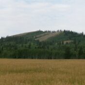
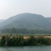
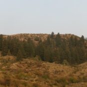
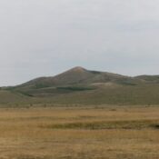
Peak 7820 by Livingston Douglas

This peak is not in the book. Published October 2025 Peak 7820 is a rugged, rocky peak located deep in the Arco Hills area of the Lost River Range. It sits above Wood Canyon and is northwest of Howe Peak (8,705 feet). USGS Arco Hills Access Same as for Peak 8170. Continue up Wood Canyon Road. At 9.8 miles, the … Continue reading

Peak 7630 by Livingston Douglas

This peak is not in the book. Published October 2025 Peak 7630 is a rocky peak that sits above Grouse Creek in the foothills of the northern Pahsimeroi Mountains. It is most easily climbed from nearby Grouse Creek Road. The drive to Peak 7630 may be your greatest challenge. USGS Meadow Peak Access From US-93 just southwest of Ellis, turn … Continue reading

Sage Hen Benchmark by Livingston Douglas

This peak is not in the book. Published October 2025 Sage Hen Benchmark sits north of Grouse Peak on a high ridge in the northern Pahsimeroi Mountains. It is most easily climbed from a nearby 2-track ridge road (FSR-111). USGS Grouse Peak Access Same as for Grouse Peak. Hike (or drive) north on FSR-111 from Grouse Peak all the way … Continue reading

Grouse Peak by Livingston Douglas

This peak is not in the book. Published October 2025 Grouse Peak is the namesake peak in this area. But, interestingly, it is not the highest point on this high ridge in the northern Pahsimeroi Mountains. That honor goes to Peak 8522 just to its south. It is most easily climbed from a nearby 2-track ridge road (FSR-111). USGS Grouse … Continue reading

Peak 8522 by Livingston Douglas

This peak is not in the book. Published October 2025 Peak 8522 sits due south of Grouse Peak (8,464 feet) on a high ridge in the northern Pahsimeroi Mountains. It is most easily climbed from a nearby 2-track ridge road (FSR-111). USGS Grouse Peak Access Same as for Peak 8387. From the road junction (at the 5.9MP on Leaton Gulch … Continue reading