Climbing and access information for this peak is on Page 82 of the book. Packsaddle Peak forms the North End of the Bitterroot Mountains. It rises east of Lake Pend Oreille and, with over 1,800 feet of prominence, is the most dominant summit in the area. USGS Packsaddle Mountain … Continue reading
Search Results for: a cl
Climbing and access information for this peak is on Page 52 of the book. Lunch Peak is reached by road. You can drive to the top but, better yet, ride your mountain bike. If you want to hike the peak, do it from Mount Pend Oreille. The Forest Service maintains a web page for this peak. USGS Trestle Peak … Continue reading
This peak is not in the book. Note as of 2023 the route set from Clear Creek Summit is now closed by the private land landowner. I do not have an update on the Dave Pahlas route. Updated October 2023 I hiked to the top of Gardiner Peak from Clear Creek Summit. Dave Pahlas climbed the peak from the west. … Continue reading
This peak is not in the book. It is located due west of ID-21 where the highway crosses Beaver Creek Summit. Peak 6682/Stargaze Point is located northeast of Pilot Peak in the Boise Mountains. I skied Stargaze Point with Brian Wright in February 2001. While not a tall or imposing summit, the skiing was good through mixed areas of forest, … Continue reading
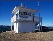
Climbing and access information for this peak is on Page 153 of the book. Updated May 2019 Danskin Peak is the highest point in the Danskin Mountains. A road leads to its summit and a large fire lookout. The road makes a great route for a mountain bike ascent. You can climb the peak from just about any direction, but … Continue reading
Climbing and access information for this peak is on Pages 60-62 of the book. Snow Peak is a rugged summit with over a thousand feet of prominence. The peak was first used as a fire lookout in 1929. The current structure was built in 1963. Trails approach the peak from several directions. USGS Montana Peak … Continue reading