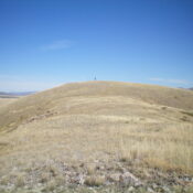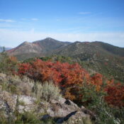
Peak 7650 by Livingston Douglas

This peak is not in the book. Published November 2023 Peak 7650 is a double-humped summit that separates Trail Canyon from Shield Canyon in the Aspen Range northeast of Soda Springs. The east summit is the actual high point (marked with a rebar post) not the official LOJ/west summit. USGS Johnson Creek Map Errors There are a number of old … Continue reading

Peak 7128 by Livingston Douglas

This peak is not in the book. Published November 2023 Peak 7128 is a scrub hump in an old mining area northeast of ID-34 and Soda Springs. It is on a mix of private and public land, so be careful. It is most easily climbed via its south ridge in combination with nearby Peak 7003. USGS Soda Springs Access Same … Continue reading

Peak 7003 by Livingston Douglas

This peak is not in the book. Published November 2023 Peak 7003 is a mostly-open scrub hump that sits at the mouth of Trail Canyon northeast of Soda Springs. It is an easy scramble up its southwest ridge from Trail Canyon Road, entirely on BLM land. USGS Soda Springs Access From the junction of US-30 and ID-34 in Soda Springs, … Continue reading

Peak 6857 by Livingston Douglas

This peak is not in the book. Published November 2023 Peak 6857 is a forested hump that sits above the mouth of Trail Canyon northeast of Soda Springs. Its northwest side is on BLM land but is a thick, forested bushwhack. USGS Soda Springs Access From the junction of US-30 and ID-34 in Soda Springs, drive north on ID-34 for … Continue reading

Threemile Knoll by Livingston Douglas

This peak is not in the book. Published November 2023 Threemile Knoll is located on the west side of ID-34 just over three miles north of Soda Springs. It is most easily climbed via its south ridge from a roadside pullout along the highway just north of a large phosphate mining facility. USGS Soda Springs Access From the junction of … Continue reading