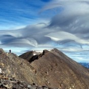
Climbing and access information for this peak is on Page 283 of the book. Updated June 2022 Access to Lost River Mountain was recently closed at the point where it first crosses private land, The access route, BLM road MK127, crosses BLM and private land as it provides access to Forest Service land at the point where Upper Cedar Creek flows out … Continue reading
Search Results for: a cl
Climbing and access information for this peak is on Page 305 of the book. This entry provides updated route information. Contents included (1) Brief notes on The Knoll to Umpleby Traverse, (2) The north ridge route, (3) The Bell Mountain to Umpleby Traverse, (4) The Basinger Canyon route and (5) Livingston Douglas’ west gully route. Updated December 2019 Umpleby is … Continue reading
Climbing and access information for this peak is on Pages 305-306 of the book. The book describes six routes on this peak. The peak’s West Ridge/West Face is the route most often climbed. This update includes additional routes and more detail on the West Ridge/West Face route. Updated June 2020 Bell Mountain is one of Idaho’s iconic landmarks. My first … Continue reading
This peak is not in the book. It is the east summit of officially-named Gilmore Peak. Based on my visual observation, I believed there was a 50/50 chance that it is actually the highest point on the Gilmore Peak massif. My observation was recently confirmed by LiDAR measurements. Gilmore Peak is discussed on Page 304 of the book. Updated December … Continue reading
Climbing and access information for this peak is on Pages 124-125 of the book. BE CAREFUL Knuckle Peak, the most impressive feature of the Bighorn Crags, is the highest point on Fishfin Ridge. The peak was first climbed by Lincoln Hales and Pete Shoening in 1955. First a couple of photos and then 2 routes not included in the book. … Continue reading