Elevation: 10,380 ft
Prominence: 760

This peak is not in the book. See Dan Robbins’ trip report linked below for another ascent route. Livingston Douglas added a new photo. Updated November 2025
The Rosencrance massif has two ranked summits: the southeast summit (Rosencrance Peak) and the northwest summit (West Rosencrance Peak). The southeast summit is just over 100 feet higher than the northwest summit. Due to very loose, steep gravel on their south sides, these peaks are most often climbed from the north from Copper Basin Road. USGS Standhope Peak

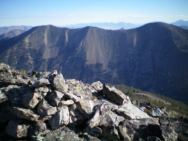
Rosencrance Peak (dead center) as viewed from West Rosencrance Peak. The west ridge (right of center) was my descent route. by Livingston Douglas
Access
Fall Creek Trail/FST-045 [(C)(2)(a) on Page 260 of the Book]. This is the first leg of a 2-peak adventure that includes Rosencrance Peak and West Rosencrance Peak (10,273 feet). It covers 6.5 miles with 3,725 feet of elevation gain round trip.
South Ridge, Class 3
The Climb
From the Fall Creek Trailhead (7,200 feet), hike 1.9 miles east then southeast up the well-beaten Fall Creek Trail/FST-045 to its log crossing of the Left Fork Fall Creek. Leave the trail just before it drops to cross the creek. Bushwhack northeast on a ridge/shoulder on the left/north side of the Left Fork Fall Creek. Quickly move away from the creek drainage itself and bushwhack up through a mix of pines and scrub (not too bad).
Once past the red gravel slopes (above and to the left), angle right-ish/northeast through the pine forest to stay on the [now-rounded] ridge crest. Keep moving right/east as necessary to stay in forested terrain. Avoid the steep, red-gravel slopes at all costs. This bushwhack is steep with more scree/gravel and less pines as you advance. The ridge bends left-ish/north and goes up a hellishly-loose, steep section of scree/gravel. Search for any pines and/or elk tracks to gain any purchase. This difficult section is in the 8,300-8,600-foot area. Move right about 100 yards to get into a forested gully to gain traction. This gully is GREAT compared to the open, loose scree/gravel.
It has scrub and pines, is not as steep, and goes pretty well, albeit with some deadfall to work around. Regrettably, this dry gully soon ends and merges left-ish/northwest into the south ridge. The ridge is now better defined and, although steep, has better traction amidst scattered pines. The pines end at about 9,300 feet but the traction is still good thanks to firmer scree/gravel and some patches of grass. Higher up, firm talus joins the mix and the ridge steepens but is manageable. At about 10,000 feet, the slope eases and tundra joins the mix. The scramble from here to the summit is on stable talus. The cairned summit of Rosencrance Peak sits on a high ridge crest. The high point is obvious.

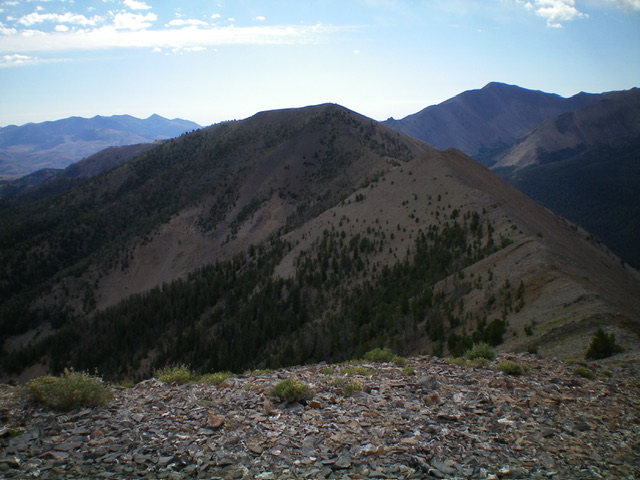
Rosencrance Peak as viewed from the valley floor to its west. The right skyline is the south ridge, my ascent route. by Livingston Douglas
West Ridge, Class 2
The Descent
From the summit, follow the ridge crest west on stable ground talus/scree with scattered ridge pines. Head down to a narrow, elongated saddle with a minor ridge hump in it. This is the 9,940-foot connecting saddle with West Rosencrance Peak (10,273 feet). It concludes the first leg of today’s 2-peak journey. West Rosencrance Peak is up next.

Rosencrance Peak (right) and West Rosencrance Peak (left) as viewed from Moose Perch. Livingston Douglas Photo

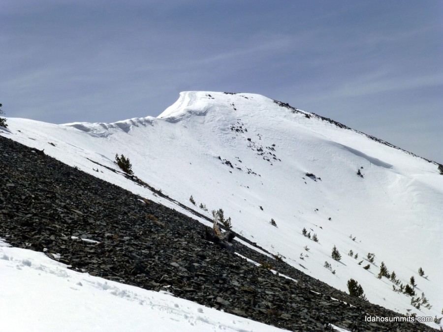
Rosencrance Peak. Dan Robbins Photo
Additional Resources
Regions: EASTERN IDAHO->Pioneer Mountains
Mountain Range: Pioneer Mountains
First Ascent Information:
- Other First Ascent: South Ridge
- Year: 2024
- Season: Summer
- Party: Livingston Douglas
Longitude: -114.0425 Latitude: 43.8592
